You are here: Home > Network List > CI - Caltech Regional Seismic Network Stations List
> Station MPP McPhearson Peak > Earthquake Result Viewer
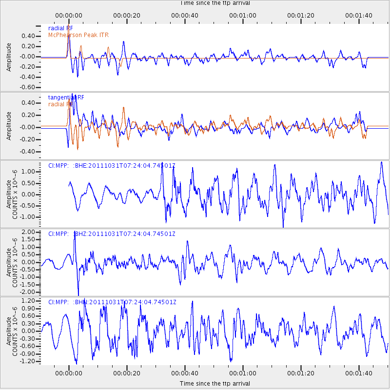
MPP McPhearson Peak - Earthquake Result Viewer
*The percent match for this event was below the threshold and hence no stack was calculated.
| Earthquake location: |
Rat Islands, Aleutian Islands |
| Earthquake latitude/longitude: |
52.4/177.9 |
| Earthquake time(UTC): |
2011/10/31 (304) 07:16:21 GMT |
| Earthquake Depth: |
159 km |
| Earthquake Magnitude: |
5.8 MB, 5.8 MW, 5.9 MW |
| Earthquake Catalog/Contributor: |
WHDF/NEIC |
|
| Network: |
CI Caltech Regional Seismic Network |
| Station: |
MPP McPhearson Peak |
| Lat/Lon: |
34.89 N/119.81 W |
| Elevation: |
1739 m |
|
| Distance: |
46.8 deg |
| Az: |
86.317 deg |
| Baz: |
311.895 deg |
| Ray Param: |
$rayparam |
*The percent match for this event was below the threshold and hence was not used in the summary stack. |
|
| Radial Match: |
59.15378 % |
| Radial Bump: |
345 |
| Transverse Match: |
70.92048 % |
| Transverse Bump: |
400 |
| SOD ConfigId: |
424168 |
| Insert Time: |
2012-02-17 13:20:37.504 +0000 |
| GWidth: |
2.5 |
| Max Bumps: |
400 |
| Tol: |
0.001 |
|
Signal To Noise
| Channel | StoN | STA | LTA |
| CI:MPP: :BHZ:20111031T07:24:04.74501Z | 3.689677 | 8.37952E-7 | 2.2710712E-7 |
| CI:MPP: :BHN:20111031T07:24:04.74501Z | 1.8822592 | 6.66348E-7 | 3.54015E-7 |
| CI:MPP: :BHE:20111031T07:24:04.74501Z | 1.9411182 | 5.6162474E-7 | 2.8933053E-7 |
| Arrivals |
| Ps | |
| PpPs | |
| PsPs/PpSs | |


