
HYB Hyderabad, India - Earthquake Result Viewer
| ||||||||||||||||||
| ||||||||||||||||||
| ||||||||||||||||||
|
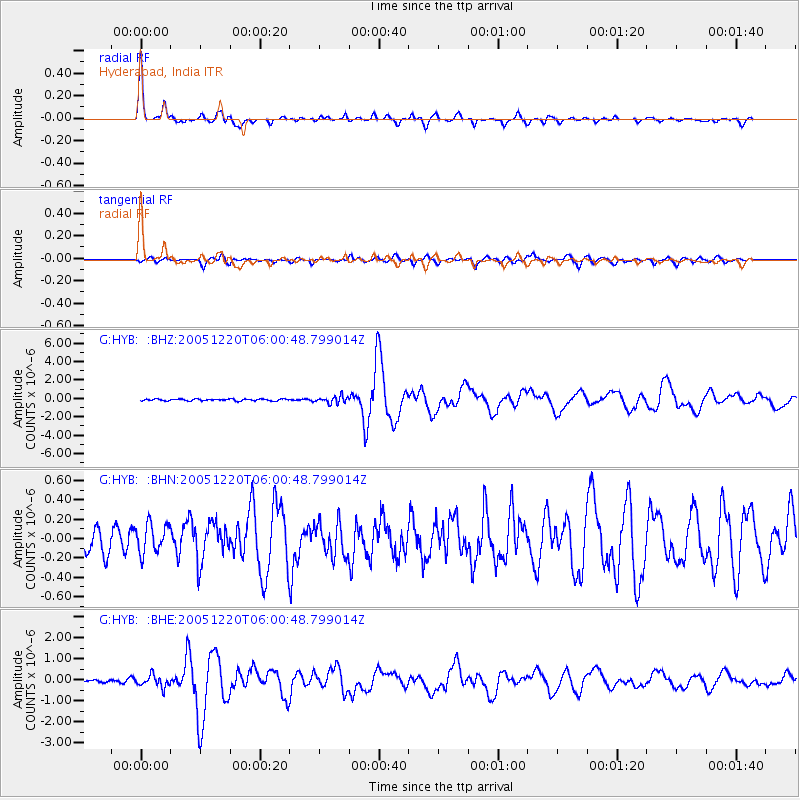
Signal To Noise
| Channel | StoN | STA | LTA |
| G:HYB: :BHN:20051220T06:00:48.799014Z | 1.3821295 | 1.5986792E-7 | 1.15667824E-7 |
| G:HYB: :BHE:20051220T06:00:48.799014Z | 2.7552767 | 2.7823762E-7 | 1.0098355E-7 |
| G:HYB: :BHZ:20051220T06:00:48.799014Z | 3.763825 | 3.7477713E-7 | 9.957347E-8 |
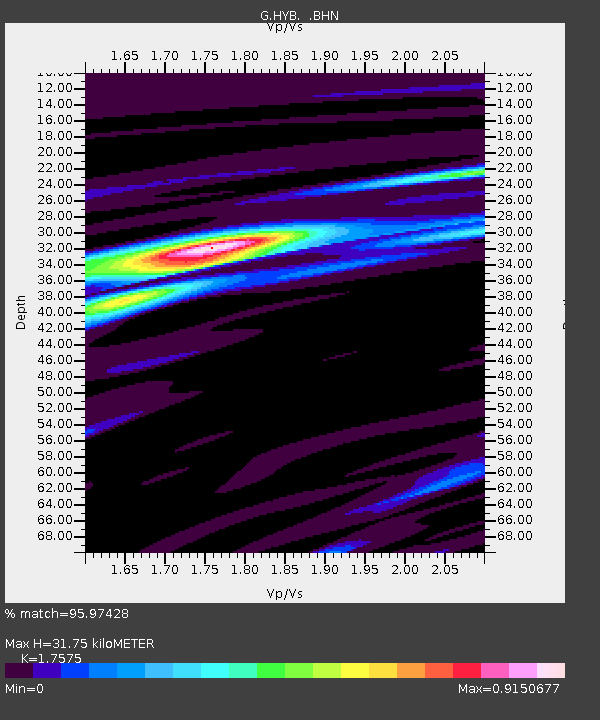
| Arrivals | |
| Ps | 3.9 SECOND |
| PpPs | 13 SECOND |
| PsPs/PpSs | 17 SECOND |

