You are here: Home > Network List > TA - USArray Transportable Network (new EarthScope stations) Stations List
> Station V36A Jenks, OK, USA > Earthquake Result Viewer
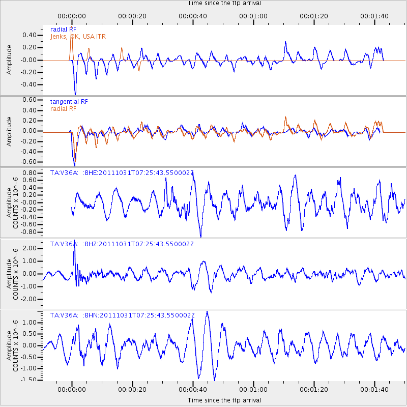
V36A Jenks, OK, USA - Earthquake Result Viewer
*The percent match for this event was below the threshold and hence no stack was calculated.
| Earthquake location: |
Rat Islands, Aleutian Islands |
| Earthquake latitude/longitude: |
52.4/177.9 |
| Earthquake time(UTC): |
2011/10/31 (304) 07:16:21 GMT |
| Earthquake Depth: |
159 km |
| Earthquake Magnitude: |
5.8 MB, 5.8 MW, 5.9 MW |
| Earthquake Catalog/Contributor: |
WHDF/NEIC |
|
| Network: |
TA USArray Transportable Network (new EarthScope stations) |
| Station: |
V36A Jenks, OK, USA |
| Lat/Lon: |
35.79 N/95.94 W |
| Elevation: |
236 m |
|
| Distance: |
60.4 deg |
| Az: |
68.865 deg |
| Baz: |
315.296 deg |
| Ray Param: |
$rayparam |
*The percent match for this event was below the threshold and hence was not used in the summary stack. |
|
| Radial Match: |
54.21337 % |
| Radial Bump: |
400 |
| Transverse Match: |
71.051384 % |
| Transverse Bump: |
400 |
| SOD ConfigId: |
424168 |
| Insert Time: |
2012-02-17 13:37:12.250 +0000 |
| GWidth: |
2.5 |
| Max Bumps: |
400 |
| Tol: |
0.001 |
|
Signal To Noise
| Channel | StoN | STA | LTA |
| TA:V36A: :BHZ:20111031T07:25:43.550002Z | 2.9130337 | 7.805556E-7 | 2.679528E-7 |
| TA:V36A: :BHN:20111031T07:25:43.550002Z | 0.9125549 | 4.8730965E-7 | 5.3400584E-7 |
| TA:V36A: :BHE:20111031T07:25:43.550002Z | 1.3968146 | 2.811374E-7 | 2.012704E-7 |
| Arrivals |
| Ps | |
| PpPs | |
| PsPs/PpSs | |


