You are here: Home > Network List > TA - USArray Transportable Network (new EarthScope stations) Stations List
> Station O03D Paynes Creek, CA, USA > Earthquake Result Viewer
O03D Paynes Creek, CA, USA - Earthquake Result Viewer
*The percent match for this event was below the threshold and hence no stack was calculated.
| Earthquake location: |
Rat Islands, Aleutian Islands |
| Earthquake latitude/longitude: |
52.4/177.9 |
| Earthquake time(UTC): |
2011/10/31 (304) 07:16:21 GMT |
| Earthquake Depth: |
159 km |
| Earthquake Magnitude: |
5.8 MB, 5.8 MW, 5.9 MW |
| Earthquake Catalog/Contributor: |
WHDF/NEIC |
|
| Network: |
TA USArray Transportable Network (new EarthScope stations) |
| Station: |
O03D Paynes Creek, CA, USA |
| Lat/Lon: |
40.29 N/121.80 W |
| Elevation: |
968 m |
|
| Distance: |
42.1 deg |
| Az: |
81.831 deg |
| Baz: |
307.481 deg |
| Ray Param: |
$rayparam |
*The percent match for this event was below the threshold and hence was not used in the summary stack. |
|
| Radial Match: |
63.66028 % |
| Radial Bump: |
400 |
| Transverse Match: |
69.825905 % |
| Transverse Bump: |
400 |
| SOD ConfigId: |
424168 |
| Insert Time: |
2012-02-17 13:39:26.251 +0000 |
| GWidth: |
2.5 |
| Max Bumps: |
400 |
| Tol: |
0.001 |
|
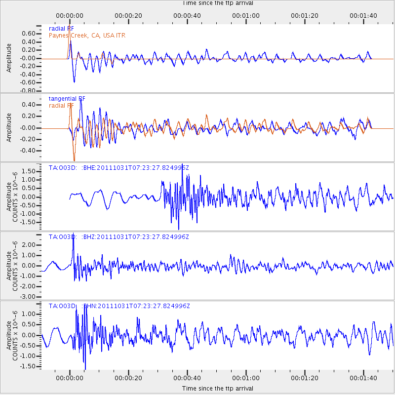
Signal To Noise
| Channel | StoN | STA | LTA |
| TA:O03D: :BHZ:20111031T07:23:27.824996Z | 3.2418745 | 9.3363354E-7 | 2.879919E-7 |
| TA:O03D: :BHN:20111031T07:23:27.824996Z | 1.9287624 | 5.3559364E-7 | 2.7768772E-7 |
| TA:O03D: :BHE:20111031T07:23:27.824996Z | 1.8410778 | 5.085045E-7 | 2.7619936E-7 |
| Arrivals |
| Ps | |
| PpPs | |
| PsPs/PpSs | |


