You are here: Home > Network List > TA - USArray Transportable Network (new EarthScope stations) Stations List
> Station Y46A Houston, MS, USA > Earthquake Result Viewer
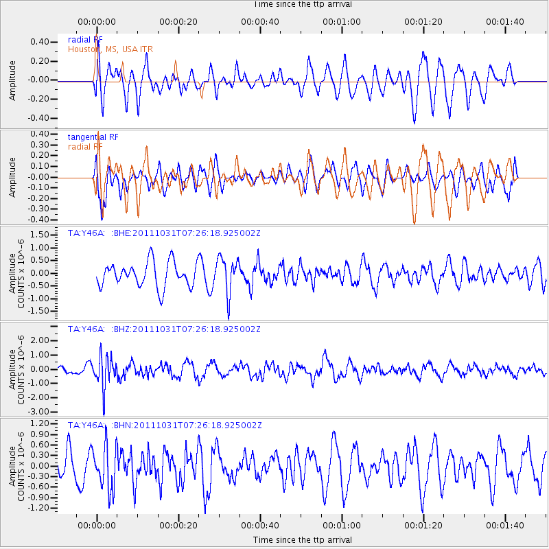
Y46A Houston, MS, USA - Earthquake Result Viewer
*The percent match for this event was below the threshold and hence no stack was calculated.
| Earthquake location: |
Rat Islands, Aleutian Islands |
| Earthquake latitude/longitude: |
52.4/177.9 |
| Earthquake time(UTC): |
2011/10/31 (304) 07:16:21 GMT |
| Earthquake Depth: |
159 km |
| Earthquake Magnitude: |
5.8 MB, 5.8 MW, 5.9 MW |
| Earthquake Catalog/Contributor: |
WHDF/NEIC |
|
| Network: |
TA USArray Transportable Network (new EarthScope stations) |
| Station: |
Y46A Houston, MS, USA |
| Lat/Lon: |
33.88 N/88.86 W |
| Elevation: |
109 m |
|
| Distance: |
65.8 deg |
| Az: |
65.583 deg |
| Baz: |
317.843 deg |
| Ray Param: |
$rayparam |
*The percent match for this event was below the threshold and hence was not used in the summary stack. |
|
| Radial Match: |
56.257202 % |
| Radial Bump: |
400 |
| Transverse Match: |
74.91107 % |
| Transverse Bump: |
400 |
| SOD ConfigId: |
424168 |
| Insert Time: |
2012-02-17 13:49:32.950 +0000 |
| GWidth: |
2.5 |
| Max Bumps: |
400 |
| Tol: |
0.001 |
|
Signal To Noise
| Channel | StoN | STA | LTA |
| TA:Y46A: :BHZ:20111031T07:26:18.925002Z | 3.7999892 | 1.0716792E-6 | 2.8202163E-7 |
| TA:Y46A: :BHN:20111031T07:26:18.925002Z | 1.4645318 | 6.269813E-7 | 4.281104E-7 |
| TA:Y46A: :BHE:20111031T07:26:18.925002Z | 1.4644388 | 7.1233023E-7 | 4.8641857E-7 |
| Arrivals |
| Ps | |
| PpPs | |
| PsPs/PpSs | |


