You are here: Home > Network List > TA - USArray Transportable Network (new EarthScope stations) Stations List
> Station L39A Vinton, IA, USA > Earthquake Result Viewer
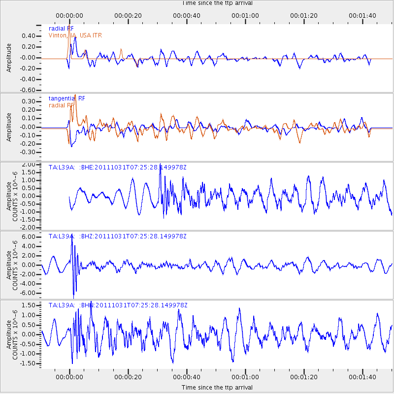
L39A Vinton, IA, USA - Earthquake Result Viewer
*The percent match for this event was below the threshold and hence no stack was calculated.
| Earthquake location: |
Rat Islands, Aleutian Islands |
| Earthquake latitude/longitude: |
52.4/177.9 |
| Earthquake time(UTC): |
2011/10/31 (304) 07:16:21 GMT |
| Earthquake Depth: |
159 km |
| Earthquake Magnitude: |
5.8 MB, 5.8 MW, 5.9 MW |
| Earthquake Catalog/Contributor: |
WHDF/NEIC |
|
| Network: |
TA USArray Transportable Network (new EarthScope stations) |
| Station: |
L39A Vinton, IA, USA |
| Lat/Lon: |
42.12 N/92.00 W |
| Elevation: |
261 m |
|
| Distance: |
58.2 deg |
| Az: |
61.113 deg |
| Baz: |
313.806 deg |
| Ray Param: |
$rayparam |
*The percent match for this event was below the threshold and hence was not used in the summary stack. |
|
| Radial Match: |
60.7012 % |
| Radial Bump: |
400 |
| Transverse Match: |
53.24031 % |
| Transverse Bump: |
400 |
| SOD ConfigId: |
424168 |
| Insert Time: |
2012-02-17 13:52:03.066 +0000 |
| GWidth: |
2.5 |
| Max Bumps: |
400 |
| Tol: |
0.001 |
|
Signal To Noise
| Channel | StoN | STA | LTA |
| TA:L39A: :BHZ:20111031T07:25:28.149978Z | 4.247267 | 2.7431374E-6 | 6.458595E-7 |
| TA:L39A: :BHN:20111031T07:25:28.149978Z | 1.6712229 | 6.5218126E-7 | 3.9024192E-7 |
| TA:L39A: :BHE:20111031T07:25:28.149978Z | 1.7203461 | 7.9567263E-7 | 4.6250727E-7 |
| Arrivals |
| Ps | |
| PpPs | |
| PsPs/PpSs | |


