You are here: Home > Network List > TA - USArray Transportable Network (new EarthScope stations) Stations List
> Station J41A Loganville, WI, USA > Earthquake Result Viewer
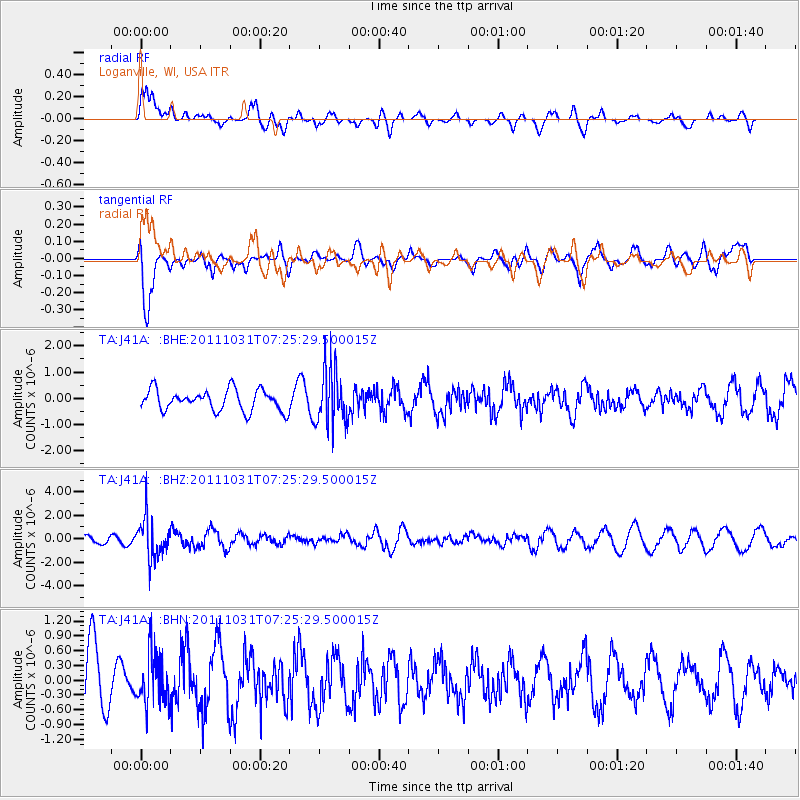
J41A Loganville, WI, USA - Earthquake Result Viewer
*The percent match for this event was below the threshold and hence no stack was calculated.
| Earthquake location: |
Rat Islands, Aleutian Islands |
| Earthquake latitude/longitude: |
52.4/177.9 |
| Earthquake time(UTC): |
2011/10/31 (304) 07:16:21 GMT |
| Earthquake Depth: |
159 km |
| Earthquake Magnitude: |
5.8 MB, 5.8 MW, 5.9 MW |
| Earthquake Catalog/Contributor: |
WHDF/NEIC |
|
| Network: |
TA USArray Transportable Network (new EarthScope stations) |
| Station: |
J41A Loganville, WI, USA |
| Lat/Lon: |
43.37 N/90.01 W |
| Elevation: |
360 m |
|
| Distance: |
58.4 deg |
| Az: |
58.868 deg |
| Baz: |
313.969 deg |
| Ray Param: |
$rayparam |
*The percent match for this event was below the threshold and hence was not used in the summary stack. |
|
| Radial Match: |
59.279083 % |
| Radial Bump: |
400 |
| Transverse Match: |
67.07455 % |
| Transverse Bump: |
400 |
| SOD ConfigId: |
424168 |
| Insert Time: |
2012-02-17 13:52:07.834 +0000 |
| GWidth: |
2.5 |
| Max Bumps: |
400 |
| Tol: |
0.001 |
|
Signal To Noise
| Channel | StoN | STA | LTA |
| TA:J41A: :BHZ:20111031T07:25:29.500015Z | 3.6763198 | 1.6641477E-6 | 4.5266674E-7 |
| TA:J41A: :BHN:20111031T07:25:29.500015Z | 1.1629598 | 5.2518345E-7 | 4.5159211E-7 |
| TA:J41A: :BHE:20111031T07:25:29.500015Z | 2.5765305 | 1.0233166E-6 | 3.9716846E-7 |
| Arrivals |
| Ps | |
| PpPs | |
| PsPs/PpSs | |


