You are here: Home > Network List > UW - Pacific Northwest Regional Seismic Network Stations List
> Station YACT Amboy, WA, USA > Earthquake Result Viewer
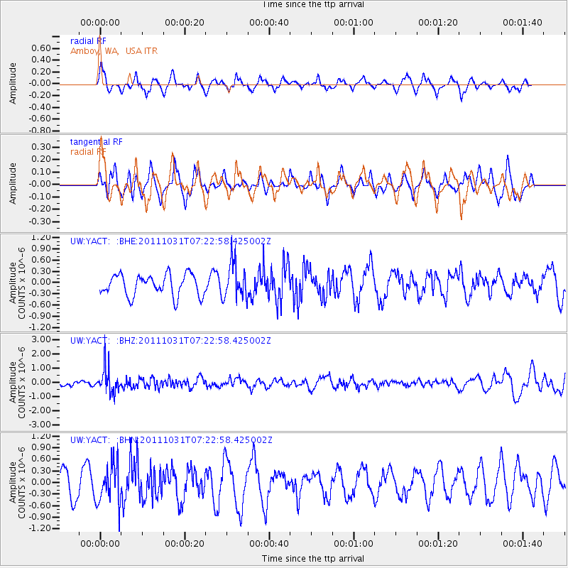
YACT Amboy, WA, USA - Earthquake Result Viewer
*The percent match for this event was below the threshold and hence no stack was calculated.
| Earthquake location: |
Rat Islands, Aleutian Islands |
| Earthquake latitude/longitude: |
52.4/177.9 |
| Earthquake time(UTC): |
2011/10/31 (304) 07:16:21 GMT |
| Earthquake Depth: |
159 km |
| Earthquake Magnitude: |
5.8 MB, 5.8 MW, 5.9 MW |
| Earthquake Catalog/Contributor: |
WHDF/NEIC |
|
| Network: |
UW Pacific Northwest Regional Seismic Network |
| Station: |
YACT Amboy, WA, USA |
| Lat/Lon: |
45.93 N/122.42 W |
| Elevation: |
211 m |
|
| Distance: |
38.6 deg |
| Az: |
75.071 deg |
| Baz: |
301.903 deg |
| Ray Param: |
$rayparam |
*The percent match for this event was below the threshold and hence was not used in the summary stack. |
|
| Radial Match: |
69.64373 % |
| Radial Bump: |
400 |
| Transverse Match: |
53.44612 % |
| Transverse Bump: |
400 |
| SOD ConfigId: |
424168 |
| Insert Time: |
2012-02-17 13:59:18.942 +0000 |
| GWidth: |
2.5 |
| Max Bumps: |
400 |
| Tol: |
0.001 |
|
Signal To Noise
| Channel | StoN | STA | LTA |
| UW:YACT: :BHZ:20111031T07:22:58.425002Z | 3.366879 | 8.9571506E-7 | 2.660372E-7 |
| UW:YACT: :BHN:20111031T07:22:58.425002Z | 1.5970558 | 5.1410956E-7 | 3.2191085E-7 |
| UW:YACT: :BHE:20111031T07:22:58.425002Z | 1.6945827 | 4.818708E-7 | 2.8435957E-7 |
| Arrivals |
| Ps | |
| PpPs | |
| PsPs/PpSs | |


