You are here: Home > Network List > UW - Pacific Northwest Regional Seismic Network Stations List
> Station LEBA Lebam, WA, USA > Earthquake Result Viewer
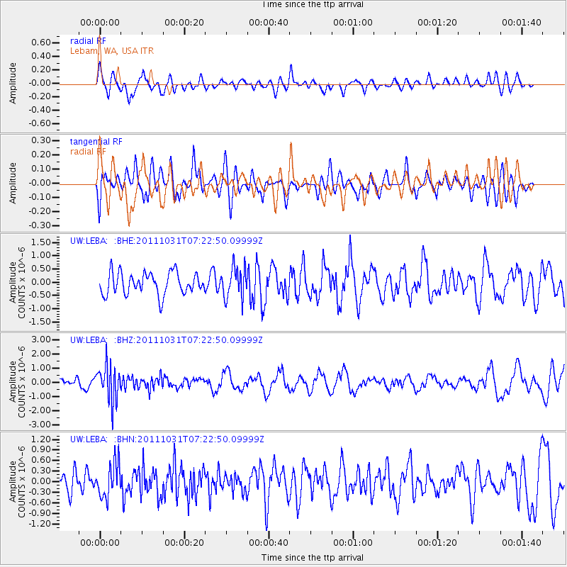
LEBA Lebam, WA, USA - Earthquake Result Viewer
*The percent match for this event was below the threshold and hence no stack was calculated.
| Earthquake location: |
Rat Islands, Aleutian Islands |
| Earthquake latitude/longitude: |
52.4/177.9 |
| Earthquake time(UTC): |
2011/10/31 (304) 07:16:21 GMT |
| Earthquake Depth: |
159 km |
| Earthquake Magnitude: |
5.8 MB, 5.8 MW, 5.9 MW |
| Earthquake Catalog/Contributor: |
WHDF/NEIC |
|
| Network: |
UW Pacific Northwest Regional Seismic Network |
| Station: |
LEBA Lebam, WA, USA |
| Lat/Lon: |
46.55 N/123.56 W |
| Elevation: |
73 m |
|
| Distance: |
37.6 deg |
| Az: |
74.893 deg |
| Baz: |
300.94 deg |
| Ray Param: |
$rayparam |
*The percent match for this event was below the threshold and hence was not used in the summary stack. |
|
| Radial Match: |
58.571228 % |
| Radial Bump: |
400 |
| Transverse Match: |
56.090855 % |
| Transverse Bump: |
400 |
| SOD ConfigId: |
424168 |
| Insert Time: |
2012-02-17 13:59:46.926 +0000 |
| GWidth: |
2.5 |
| Max Bumps: |
400 |
| Tol: |
0.001 |
|
Signal To Noise
| Channel | StoN | STA | LTA |
| UW:LEBA: :BHZ:20111031T07:22:50.09999Z | 3.5946531 | 1.2500739E-6 | 3.4775925E-7 |
| UW:LEBA: :BHN:20111031T07:22:50.09999Z | 1.3215303 | 4.890289E-7 | 3.700474E-7 |
| UW:LEBA: :BHE:20111031T07:22:50.09999Z | 1.4145826 | 5.831683E-7 | 4.1225465E-7 |
| Arrivals |
| Ps | |
| PpPs | |
| PsPs/PpSs | |


