You are here: Home > Network List > TA - USArray Transportable Network (new EarthScope stations) Stations List
> Station 121A Cookes Peak, Deming, NM, USA > Earthquake Result Viewer
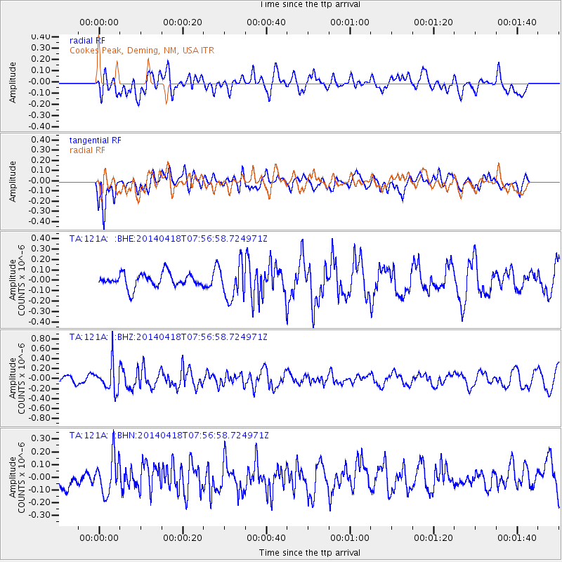
121A Cookes Peak, Deming, NM, USA - Earthquake Result Viewer
*The percent match for this event was below the threshold and hence no stack was calculated.
| Earthquake location: |
Santiago Del Estero Prov., Arg. |
| Earthquake latitude/longitude: |
-27.7/-62.8 |
| Earthquake time(UTC): |
2014/04/18 (108) 07:46:57 GMT |
| Earthquake Depth: |
610 km |
| Earthquake Magnitude: |
5.6 MW |
| Earthquake Catalog/Contributor: |
ISC/ISC |
|
| Network: |
TA USArray Transportable Network (new EarthScope stations) |
| Station: |
121A Cookes Peak, Deming, NM, USA |
| Lat/Lon: |
32.53 N/107.79 W |
| Elevation: |
1652 m |
|
| Distance: |
73.6 deg |
| Az: |
321.517 deg |
| Baz: |
139.233 deg |
| Ray Param: |
$rayparam |
*The percent match for this event was below the threshold and hence was not used in the summary stack. |
|
| Radial Match: |
43.92312 % |
| Radial Bump: |
400 |
| Transverse Match: |
37.96673 % |
| Transverse Bump: |
400 |
| SOD ConfigId: |
3390531 |
| Insert Time: |
2019-04-11 10:59:45.293 +0000 |
| GWidth: |
2.5 |
| Max Bumps: |
400 |
| Tol: |
0.001 |
|
Signal To Noise
| Channel | StoN | STA | LTA |
| TA:121A: :BHZ:20140418T07:56:58.724971Z | 3.4237986 | 2.6522258E-7 | 7.746443E-8 |
| TA:121A: :BHN:20140418T07:56:58.724971Z | 1.3767936 | 1.4919435E-7 | 1.0836363E-7 |
| TA:121A: :BHE:20140418T07:56:58.724971Z | 2.5314958 | 1.6750246E-7 | 6.616739E-8 |
| Arrivals |
| Ps | |
| PpPs | |
| PsPs/PpSs | |


