You are here: Home > Network List > UW - Pacific Northwest Regional Seismic Network Stations List
> Station MRBL Marblemount, WA, USA > Earthquake Result Viewer
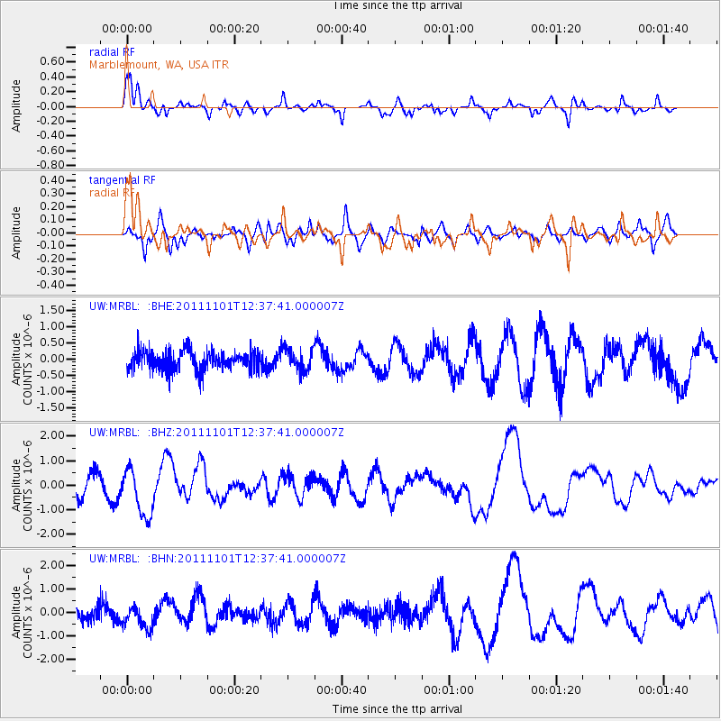
MRBL Marblemount, WA, USA - Earthquake Result Viewer
*The percent match for this event was below the threshold and hence no stack was calculated.
| Earthquake location: |
Revilla Gigedo Islands Region |
| Earthquake latitude/longitude: |
19.8/-109.2 |
| Earthquake time(UTC): |
2011/11/01 (305) 12:32:00 GMT |
| Earthquake Depth: |
10 km |
| Earthquake Magnitude: |
5.6 MB, 5.9 MS, 6.3 MW, 6.3 MW |
| Earthquake Catalog/Contributor: |
WHDF/NEIC |
|
| Network: |
UW Pacific Northwest Regional Seismic Network |
| Station: |
MRBL Marblemount, WA, USA |
| Lat/Lon: |
48.52 N/121.48 W |
| Elevation: |
75 m |
|
| Distance: |
30.3 deg |
| Az: |
343.717 deg |
| Baz: |
156.609 deg |
| Ray Param: |
$rayparam |
*The percent match for this event was below the threshold and hence was not used in the summary stack. |
|
| Radial Match: |
78.00648 % |
| Radial Bump: |
400 |
| Transverse Match: |
62.65755 % |
| Transverse Bump: |
400 |
| SOD ConfigId: |
424168 |
| Insert Time: |
2012-02-17 14:21:43.558 +0000 |
| GWidth: |
2.5 |
| Max Bumps: |
400 |
| Tol: |
0.001 |
|
Signal To Noise
| Channel | StoN | STA | LTA |
| UW:MRBL: :BHZ:20111101T12:37:41.000007Z | 2.4157984 | 9.887832E-7 | 4.092987E-7 |
| UW:MRBL: :BHN:20111101T12:37:41.000007Z | 1.1399661 | 4.976021E-7 | 4.3650604E-7 |
| UW:MRBL: :BHE:20111101T12:37:41.000007Z | 1.1204879 | 3.3393883E-7 | 2.9802985E-7 |
| Arrivals |
| Ps | |
| PpPs | |
| PsPs/PpSs | |


