You are here: Home > Network List > CI - Caltech Regional Seismic Network Stations List
> Station LRL Laurel Mtn Radio Fac, Ridgecrest, CA, USA > Earthquake Result Viewer
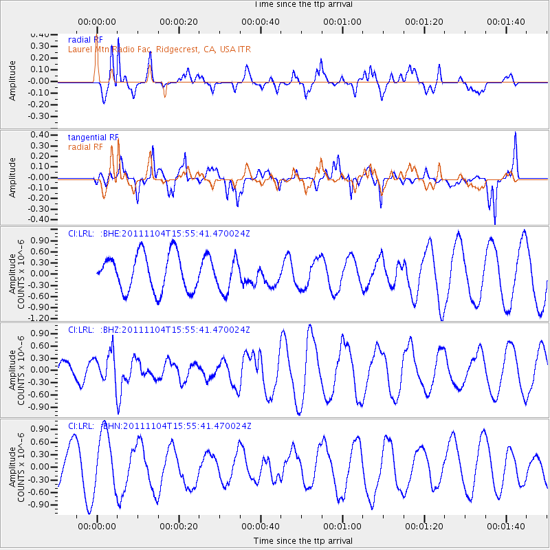
LRL Laurel Mtn Radio Fac, Ridgecrest, CA, USA - Earthquake Result Viewer
*The percent match for this event was below the threshold and hence no stack was calculated.
| Earthquake location: |
Vanuatu Islands |
| Earthquake latitude/longitude: |
-15.1/167.4 |
| Earthquake time(UTC): |
2011/11/04 (308) 15:43:43 GMT |
| Earthquake Depth: |
134 km |
| Earthquake Magnitude: |
5.6 MB, 5.8 MW, 5.8 MW |
| Earthquake Catalog/Contributor: |
WHDF/NEIC |
|
| Network: |
CI Caltech Regional Seismic Network |
| Station: |
LRL Laurel Mtn Radio Fac, Ridgecrest, CA, USA |
| Lat/Lon: |
35.48 N/117.68 W |
| Elevation: |
1340 m |
|
| Distance: |
86.8 deg |
| Az: |
52.122 deg |
| Baz: |
249.094 deg |
| Ray Param: |
$rayparam |
*The percent match for this event was below the threshold and hence was not used in the summary stack. |
|
| Radial Match: |
68.75951 % |
| Radial Bump: |
363 |
| Transverse Match: |
81.3534 % |
| Transverse Bump: |
400 |
| SOD ConfigId: |
424168 |
| Insert Time: |
2012-02-17 14:28:38.171 +0000 |
| GWidth: |
2.5 |
| Max Bumps: |
400 |
| Tol: |
0.001 |
|
Signal To Noise
| Channel | StoN | STA | LTA |
| CI:LRL: :BHZ:20111104T15:55:41.470024Z | 1.3924619 | 3.7973047E-7 | 2.727044E-7 |
| CI:LRL: :BHN:20111104T15:55:41.470024Z | 2.278067 | 7.1825735E-7 | 3.1529248E-7 |
| CI:LRL: :BHE:20111104T15:55:41.470024Z | 0.9125483 | 4.4397612E-7 | 4.8652345E-7 |
| Arrivals |
| Ps | |
| PpPs | |
| PsPs/PpSs | |


