You are here: Home > Network List > US - United States National Seismic Network Stations List
> Station MNTX Cornudas Mountains, Texas, USA > Earthquake Result Viewer
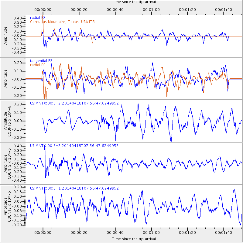
MNTX Cornudas Mountains, Texas, USA - Earthquake Result Viewer
*The percent match for this event was below the threshold and hence no stack was calculated.
| Earthquake location: |
Santiago Del Estero Prov., Arg. |
| Earthquake latitude/longitude: |
-27.7/-62.8 |
| Earthquake time(UTC): |
2014/04/18 (108) 07:46:57 GMT |
| Earthquake Depth: |
610 km |
| Earthquake Magnitude: |
5.6 MW |
| Earthquake Catalog/Contributor: |
ISC/ISC |
|
| Network: |
US United States National Seismic Network |
| Station: |
MNTX Cornudas Mountains, Texas, USA |
| Lat/Lon: |
31.70 N/105.38 W |
| Elevation: |
404 m |
|
| Distance: |
71.7 deg |
| Az: |
322.595 deg |
| Baz: |
140.826 deg |
| Ray Param: |
$rayparam |
*The percent match for this event was below the threshold and hence was not used in the summary stack. |
|
| Radial Match: |
61.248978 % |
| Radial Bump: |
400 |
| Transverse Match: |
34.713055 % |
| Transverse Bump: |
400 |
| SOD ConfigId: |
3390531 |
| Insert Time: |
2019-04-11 11:02:12.025 +0000 |
| GWidth: |
2.5 |
| Max Bumps: |
400 |
| Tol: |
0.001 |
|
Signal To Noise
| Channel | StoN | STA | LTA |
| US:MNTX:00:BHZ:20140418T07:56:47.624995Z | 2.3903615 | 1.7386141E-7 | 7.273436E-8 |
| US:MNTX:00:BH1:20140418T07:56:47.624995Z | 0.71391517 | 6.814884E-8 | 9.54579E-8 |
| US:MNTX:00:BH2:20140418T07:56:47.624995Z | 0.8212897 | 4.253538E-8 | 5.1790956E-8 |
| Arrivals |
| Ps | |
| PpPs | |
| PsPs/PpSs | |


