You are here: Home > Network List > UW - Pacific Northwest Regional Seismic Network Stations List
> Station MRBL Marblemount, WA, USA > Earthquake Result Viewer
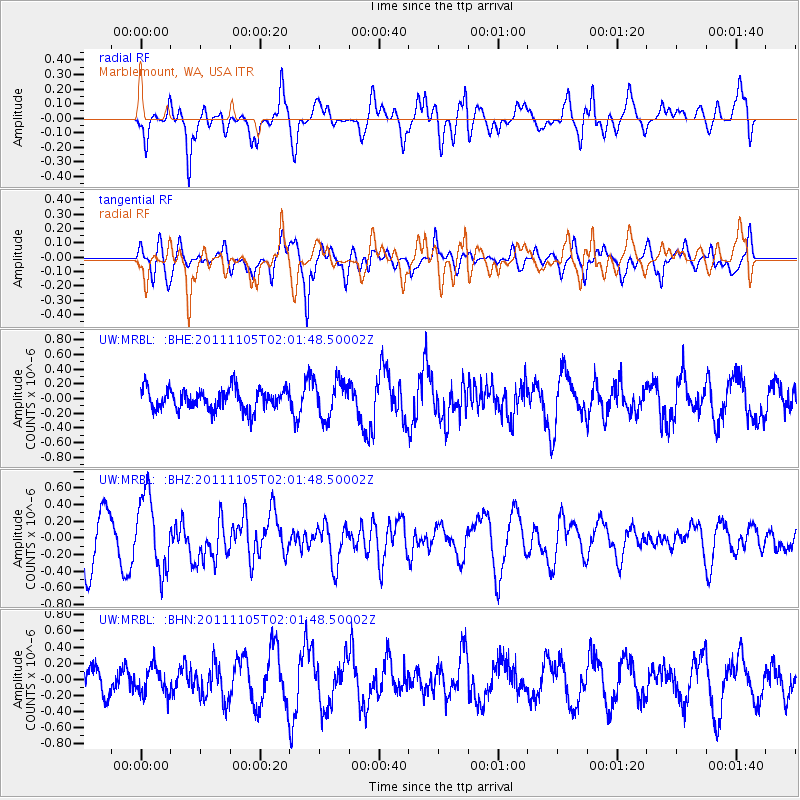
MRBL Marblemount, WA, USA - Earthquake Result Viewer
*The percent match for this event was below the threshold and hence no stack was calculated.
| Earthquake location: |
Vanuatu Islands |
| Earthquake latitude/longitude: |
-18.2/168.3 |
| Earthquake time(UTC): |
2011/11/05 (309) 01:49:18 GMT |
| Earthquake Depth: |
35 km |
| Earthquake Magnitude: |
5.8 MB, 5.5 MS, 5.9 MW, 5.8 MW |
| Earthquake Catalog/Contributor: |
WHDF/NEIC |
|
| Network: |
UW Pacific Northwest Regional Seismic Network |
| Station: |
MRBL Marblemount, WA, USA |
| Lat/Lon: |
48.52 N/121.48 W |
| Elevation: |
75 m |
|
| Distance: |
91.1 deg |
| Az: |
38.735 deg |
| Baz: |
243.431 deg |
| Ray Param: |
$rayparam |
*The percent match for this event was below the threshold and hence was not used in the summary stack. |
|
| Radial Match: |
73.72886 % |
| Radial Bump: |
400 |
| Transverse Match: |
65.77118 % |
| Transverse Bump: |
400 |
| SOD ConfigId: |
424168 |
| Insert Time: |
2012-02-24 04:36:13.390 +0000 |
| GWidth: |
2.5 |
| Max Bumps: |
400 |
| Tol: |
0.001 |
|
Signal To Noise
| Channel | StoN | STA | LTA |
| UW:MRBL: :BHZ:20111105T02:01:48.50002Z | 1.5427282 | 4.4773245E-7 | 2.902212E-7 |
| UW:MRBL: :BHN:20111105T02:01:48.50002Z | 0.9456216 | 1.6609472E-7 | 1.7564608E-7 |
| UW:MRBL: :BHE:20111105T02:01:48.50002Z | 1.7551318 | 2.503794E-7 | 1.4265561E-7 |
| Arrivals |
| Ps | |
| PpPs | |
| PsPs/PpSs | |


