You are here: Home > Network List > TA - USArray Transportable Network (new EarthScope stations) Stations List
> Station C36A Pine Crest Fram, Angora, MN, USA > Earthquake Result Viewer
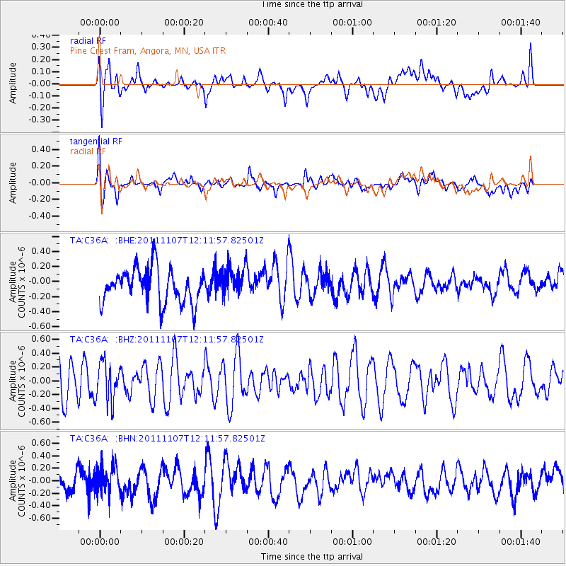
C36A Pine Crest Fram, Angora, MN, USA - Earthquake Result Viewer
*The percent match for this event was below the threshold and hence no stack was calculated.
| Earthquake location: |
Afghanistan-Tajikistan Bord Reg. |
| Earthquake latitude/longitude: |
36.5/71.1 |
| Earthquake time(UTC): |
2011/11/07 (311) 11:59:31 GMT |
| Earthquake Depth: |
212 km |
| Earthquake Magnitude: |
5.7 MB, 5.6 MW, 5.7 MW |
| Earthquake Catalog/Contributor: |
WHDF/NEIC |
|
| Network: |
TA USArray Transportable Network (new EarthScope stations) |
| Station: |
C36A Pine Crest Fram, Angora, MN, USA |
| Lat/Lon: |
47.76 N/92.84 W |
| Elevation: |
410 m |
|
| Distance: |
94.9 deg |
| Az: |
349.202 deg |
| Baz: |
12.928 deg |
| Ray Param: |
$rayparam |
*The percent match for this event was below the threshold and hence was not used in the summary stack. |
|
| Radial Match: |
47.86949 % |
| Radial Bump: |
400 |
| Transverse Match: |
55.35353 % |
| Transverse Bump: |
400 |
| SOD ConfigId: |
424168 |
| Insert Time: |
2012-02-24 05:17:43.873 +0000 |
| GWidth: |
2.5 |
| Max Bumps: |
400 |
| Tol: |
0.001 |
|
Signal To Noise
| Channel | StoN | STA | LTA |
| TA:C36A: :BHZ:20111107T12:11:57.82501Z | 1.2181158 | 2.8037527E-7 | 2.3017128E-7 |
| TA:C36A: :BHN:20111107T12:11:57.82501Z | 0.8144196 | 2.1625857E-7 | 2.6553704E-7 |
| TA:C36A: :BHE:20111107T12:11:57.82501Z | 0.8572993 | 1.9494647E-7 | 2.2739604E-7 |
| Arrivals |
| Ps | |
| PpPs | |
| PsPs/PpSs | |


