You are here: Home > Network List > TA - USArray Transportable Network (new EarthScope stations) Stations List
> Station G42A Mountain, WI, USA > Earthquake Result Viewer
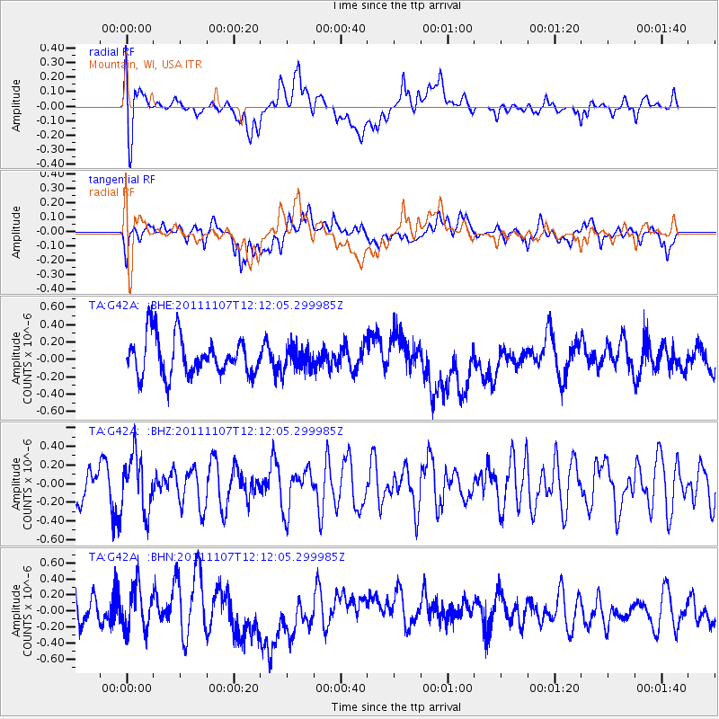
G42A Mountain, WI, USA - Earthquake Result Viewer
*The percent match for this event was below the threshold and hence no stack was calculated.
| Earthquake location: |
Afghanistan-Tajikistan Bord Reg. |
| Earthquake latitude/longitude: |
36.5/71.1 |
| Earthquake time(UTC): |
2011/11/07 (311) 11:59:31 GMT |
| Earthquake Depth: |
212 km |
| Earthquake Magnitude: |
5.7 MB, 5.6 MW, 5.7 MW |
| Earthquake Catalog/Contributor: |
WHDF/NEIC |
|
| Network: |
TA USArray Transportable Network (new EarthScope stations) |
| Station: |
G42A Mountain, WI, USA |
| Lat/Lon: |
45.24 N/88.43 W |
| Elevation: |
315 m |
|
| Distance: |
96.6 deg |
| Az: |
345.599 deg |
| Baz: |
16.478 deg |
| Ray Param: |
$rayparam |
*The percent match for this event was below the threshold and hence was not used in the summary stack. |
|
| Radial Match: |
43.606007 % |
| Radial Bump: |
400 |
| Transverse Match: |
44.335175 % |
| Transverse Bump: |
400 |
| SOD ConfigId: |
424168 |
| Insert Time: |
2012-02-24 05:18:47.330 +0000 |
| GWidth: |
2.5 |
| Max Bumps: |
400 |
| Tol: |
0.001 |
|
Signal To Noise
| Channel | StoN | STA | LTA |
| TA:G42A: :BHZ:20111107T12:12:05.299985Z | 1.1392598 | 2.9337696E-7 | 2.575154E-7 |
| TA:G42A: :BHN:20111107T12:12:05.299985Z | 1.0288967 | 2.6870455E-7 | 2.6115796E-7 |
| TA:G42A: :BHE:20111107T12:12:05.299985Z | 0.61393976 | 1.3451032E-7 | 2.1909368E-7 |
| Arrivals |
| Ps | |
| PpPs | |
| PsPs/PpSs | |


