You are here: Home > Network List > NE - New England Seismic Network Stations List
> Station EMMW Machias, ME > Earthquake Result Viewer
EMMW Machias, ME - Earthquake Result Viewer

| Earthquake location: |
Nicaragua |
| Earthquake latitude/longitude: |
11.6/-85.9 |
| Earthquake time(UTC): |
2011/11/07 (311) 22:35:25 GMT |
| Earthquake Depth: |
177 km |
| Earthquake Magnitude: |
6.0 MB, 6.0 MW, 6.1 MW |
| Earthquake Catalog/Contributor: |
WHDF/NEIC |
|
| Network: |
NE New England Seismic Network |
| Station: |
EMMW Machias, ME |
| Lat/Lon: |
44.71 N/67.46 W |
| Elevation: |
34 m |
|
| Distance: |
36.6 deg |
| Az: |
22.172 deg |
| Baz: |
211.243 deg |
| Ray Param: |
0.07594417 |
| Estimated Moho Depth: |
38.25 km |
| Estimated Crust Vp/Vs: |
1.66 |
| Assumed Crust Vp: |
6.419 km/s |
| Estimated Crust Vs: |
3.855 km/s |
| Estimated Crust Poisson's Ratio: |
0.22 |
|
| Radial Match: |
81.74622 % |
| Radial Bump: |
275 |
| Transverse Match: |
57.844913 % |
| Transverse Bump: |
400 |
| SOD ConfigId: |
424168 |
| Insert Time: |
2012-02-24 05:38:01.321 +0000 |
| GWidth: |
2.5 |
| Max Bumps: |
400 |
| Tol: |
0.001 |
|
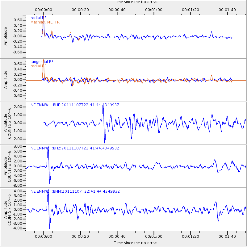
Signal To Noise
| Channel | StoN | STA | LTA |
| NE:EMMW: :BHZ:20111107T22:41:44.434993Z | 10.731282 | 3.4684688E-6 | 3.2321103E-7 |
| NE:EMMW: :BHN:20111107T22:41:44.434993Z | 7.520807 | 1.853377E-6 | 2.4643325E-7 |
| NE:EMMW: :BHE:20111107T22:41:44.434993Z | 6.383137 | 1.1333378E-6 | 1.7755187E-7 |
| Arrivals |
| Ps | 4.3 SECOND |
| PpPs | 15 SECOND |
| PsPs/PpSs | 19 SECOND |


