You are here: Home > Network List > TA - USArray Transportable Network (new EarthScope stations) Stations List
> Station R11A Troy Canyon, Currant, NV, USA > Earthquake Result Viewer
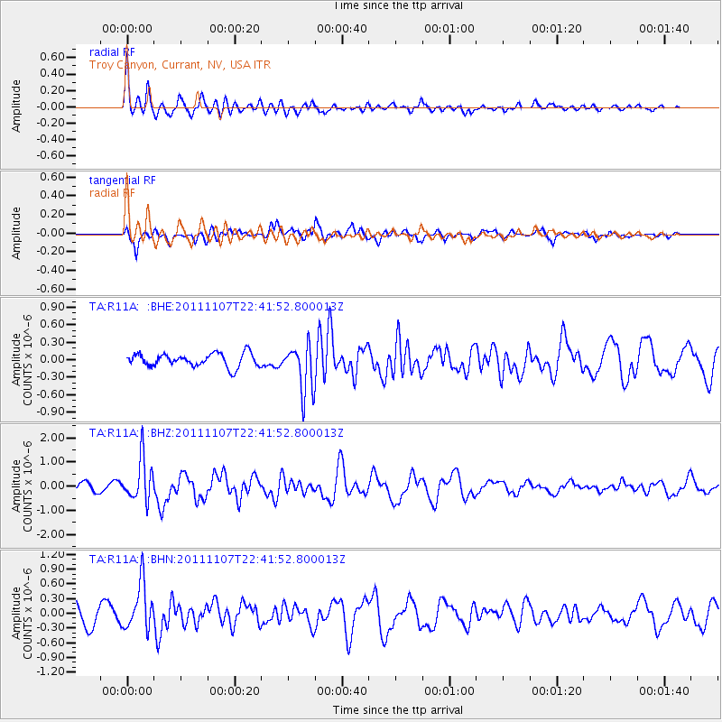
R11A Troy Canyon, Currant, NV, USA - Earthquake Result Viewer
*The percent match for this event was below the threshold and hence no stack was calculated.
| Earthquake location: |
Nicaragua |
| Earthquake latitude/longitude: |
11.6/-85.9 |
| Earthquake time(UTC): |
2011/11/07 (311) 22:35:25 GMT |
| Earthquake Depth: |
177 km |
| Earthquake Magnitude: |
6.0 MB, 6.0 MW, 6.1 MW |
| Earthquake Catalog/Contributor: |
WHDF/NEIC |
|
| Network: |
TA USArray Transportable Network (new EarthScope stations) |
| Station: |
R11A Troy Canyon, Currant, NV, USA |
| Lat/Lon: |
38.35 N/115.59 W |
| Elevation: |
1756 m |
|
| Distance: |
37.6 deg |
| Az: |
320.299 deg |
| Baz: |
127.235 deg |
| Ray Param: |
$rayparam |
*The percent match for this event was below the threshold and hence was not used in the summary stack. |
|
| Radial Match: |
55.582573 % |
| Radial Bump: |
400 |
| Transverse Match: |
87.34956 % |
| Transverse Bump: |
367 |
| SOD ConfigId: |
424168 |
| Insert Time: |
2012-02-24 05:39:29.341 +0000 |
| GWidth: |
2.5 |
| Max Bumps: |
400 |
| Tol: |
0.001 |
|
Signal To Noise
| Channel | StoN | STA | LTA |
| TA:R11A: :BHZ:20111107T22:41:52.800013Z | 6.300786 | 8.7196963E-7 | 1.3839062E-7 |
| TA:R11A: :BHN:20111107T22:41:52.800013Z | 2.9827635 | 4.846816E-7 | 1.6249413E-7 |
| TA:R11A: :BHE:20111107T22:41:52.800013Z | 3.6396344 | 4.135446E-7 | 1.1362257E-7 |
| Arrivals |
| Ps | |
| PpPs | |
| PsPs/PpSs | |


