
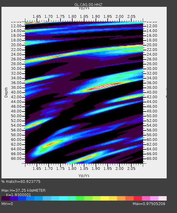
CAG Carmichael - Earthquake Result Viewer
| ||||||||||||||||||
| ||||||||||||||||||
| ||||||||||||||||||
|
Signal To Noise
| Channel | StoN | STA | LTA |
| GL:CAG:00:HHZ:20140418T14:34:07.039993Z | 19.496054 | 9.656958E-6 | 4.953289E-7 |
| GL:CAG:00:HHN:20140418T14:34:07.039993Z | 1.3515794 | 1.929653E-6 | 1.4277023E-6 |
| GL:CAG:00:HHE:20140418T14:34:07.039993Z | 4.742069 | 7.5067546E-6 | 1.5830127E-6 |
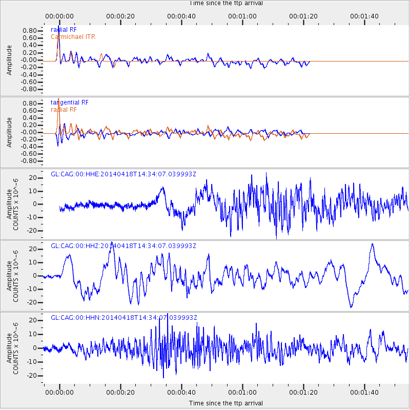
| Arrivals | |
| Ps | 6.1 SECOND |
| PpPs | 17 SECOND |
| PsPs/PpSs | 23 SECOND |

