You are here: Home > Network List > TA - USArray Transportable Network (new EarthScope stations) Stations List
> Station F39A Loretta, WI, USA > Earthquake Result Viewer
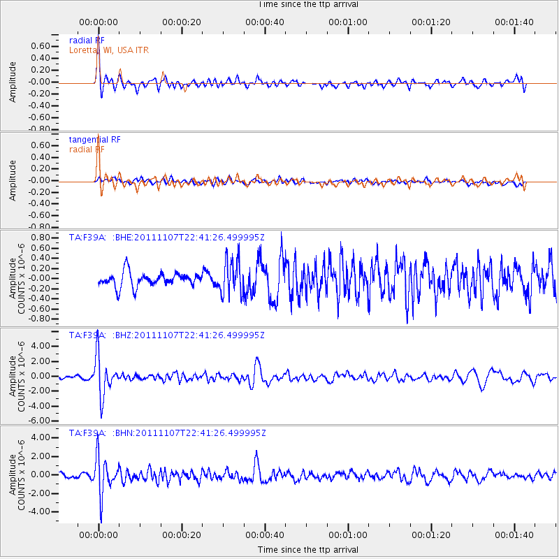
F39A Loretta, WI, USA - Earthquake Result Viewer
*The percent match for this event was below the threshold and hence no stack was calculated.
| Earthquake location: |
Nicaragua |
| Earthquake latitude/longitude: |
11.6/-85.9 |
| Earthquake time(UTC): |
2011/11/07 (311) 22:35:25 GMT |
| Earthquake Depth: |
177 km |
| Earthquake Magnitude: |
6.0 MB, 6.0 MW, 6.1 MW |
| Earthquake Catalog/Contributor: |
WHDF/NEIC |
|
| Network: |
TA USArray Transportable Network (new EarthScope stations) |
| Station: |
F39A Loretta, WI, USA |
| Lat/Lon: |
45.92 N/90.92 W |
| Elevation: |
440 m |
|
| Distance: |
34.5 deg |
| Az: |
353.763 deg |
| Baz: |
171.228 deg |
| Ray Param: |
$rayparam |
*The percent match for this event was below the threshold and hence was not used in the summary stack. |
|
| Radial Match: |
79.55446 % |
| Radial Bump: |
400 |
| Transverse Match: |
63.30252 % |
| Transverse Bump: |
400 |
| SOD ConfigId: |
424168 |
| Insert Time: |
2012-02-24 05:53:30.699 +0000 |
| GWidth: |
2.5 |
| Max Bumps: |
400 |
| Tol: |
0.001 |
|
Signal To Noise
| Channel | StoN | STA | LTA |
| TA:F39A: :BHZ:20111107T22:41:26.499995Z | 13.581545 | 2.7012459E-6 | 1.9889092E-7 |
| TA:F39A: :BHN:20111107T22:41:26.499995Z | 10.580571 | 2.0523566E-6 | 1.9397409E-7 |
| TA:F39A: :BHE:20111107T22:41:26.499995Z | 2.4356062 | 3.3863623E-7 | 1.3903569E-7 |
| Arrivals |
| Ps | |
| PpPs | |
| PsPs/PpSs | |


