You are here: Home > Network List > TA - USArray Transportable Network (new EarthScope stations) Stations List
> Station L04D Klamath Falls, OR, USA > Earthquake Result Viewer
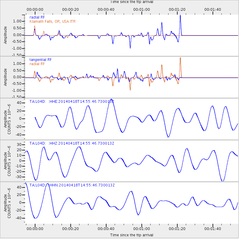
L04D Klamath Falls, OR, USA - Earthquake Result Viewer
*The percent match for this event was below the threshold and hence no stack was calculated.
| Earthquake location: |
Near Coast Of Guerrero, Mexico |
| Earthquake latitude/longitude: |
17.3/-101.2 |
| Earthquake time(UTC): |
2014/04/18 (108) 14:50:02 GMT |
| Earthquake Depth: |
9.3 km |
| Earthquake Magnitude: |
4.5 mb |
| Earthquake Catalog/Contributor: |
ISC/ISC |
|
| Network: |
TA USArray Transportable Network (new EarthScope stations) |
| Station: |
L04D Klamath Falls, OR, USA |
| Lat/Lon: |
42.22 N/122.30 W |
| Elevation: |
1437 m |
|
| Distance: |
30.7 deg |
| Az: |
328.484 deg |
| Baz: |
137.745 deg |
| Ray Param: |
$rayparam |
*The percent match for this event was below the threshold and hence was not used in the summary stack. |
|
| Radial Match: |
69.17605 % |
| Radial Bump: |
387 |
| Transverse Match: |
61.322414 % |
| Transverse Bump: |
400 |
| SOD ConfigId: |
3390531 |
| Insert Time: |
2019-04-11 11:16:46.548 +0000 |
| GWidth: |
2.5 |
| Max Bumps: |
400 |
| Tol: |
0.001 |
|
Signal To Noise
| Channel | StoN | STA | LTA |
| TA:L04D: :HHZ:20140418T14:55:46.730013Z | 4.209978 | 2.5181045E-5 | 5.981277E-6 |
| TA:L04D: :HHN:20140418T14:55:46.730013Z | 1.0569953 | 2.8349374E-5 | 2.6820719E-5 |
| TA:L04D: :HHE:20140418T14:55:46.730013Z | 1.7553618 | 2.5781312E-5 | 1.4687179E-5 |
| Arrivals |
| Ps | |
| PpPs | |
| PsPs/PpSs | |


