You are here: Home > Network List > UW - Pacific Northwest Regional Seismic Network Stations List
> Station MRBL Marblemount, WA, USA > Earthquake Result Viewer
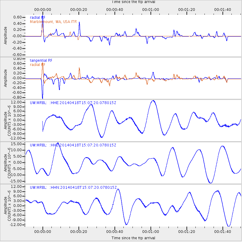
MRBL Marblemount, WA, USA - Earthquake Result Viewer
*The percent match for this event was below the threshold and hence no stack was calculated.
| Earthquake location: |
Solomon Islands |
| Earthquake latitude/longitude: |
-6.8/154.5 |
| Earthquake time(UTC): |
2014/04/18 (108) 14:54:51 GMT |
| Earthquake Depth: |
39 km |
| Earthquake Magnitude: |
4.5 mb |
| Earthquake Catalog/Contributor: |
ISC/ISC |
|
| Network: |
UW Pacific Northwest Regional Seismic Network |
| Station: |
MRBL Marblemount, WA, USA |
| Lat/Lon: |
48.52 N/121.48 W |
| Elevation: |
75 m |
|
| Distance: |
91.1 deg |
| Az: |
41.401 deg |
| Baz: |
261.049 deg |
| Ray Param: |
$rayparam |
*The percent match for this event was below the threshold and hence was not used in the summary stack. |
|
| Radial Match: |
38.10719 % |
| Radial Bump: |
400 |
| Transverse Match: |
57.966873 % |
| Transverse Bump: |
371 |
| SOD ConfigId: |
3390531 |
| Insert Time: |
2019-04-11 11:21:23.693 +0000 |
| GWidth: |
2.5 |
| Max Bumps: |
400 |
| Tol: |
0.001 |
|
Signal To Noise
| Channel | StoN | STA | LTA |
| UW:MRBL: :HHZ:20140418T15:07:20.078015Z | 2.0349789 | 7.990395E-6 | 3.9265246E-6 |
| UW:MRBL: :HHN:20140418T15:07:20.078015Z | 1.4962118 | 3.7859786E-6 | 2.5303762E-6 |
| UW:MRBL: :HHE:20140418T15:07:20.078015Z | 2.069539 | 7.6200663E-6 | 3.6820113E-6 |
| Arrivals |
| Ps | |
| PpPs | |
| PsPs/PpSs | |


