You are here: Home > Network List > CI - Caltech Regional Seismic Network Stations List
> Station MPP McPhearson Peak > Earthquake Result Viewer
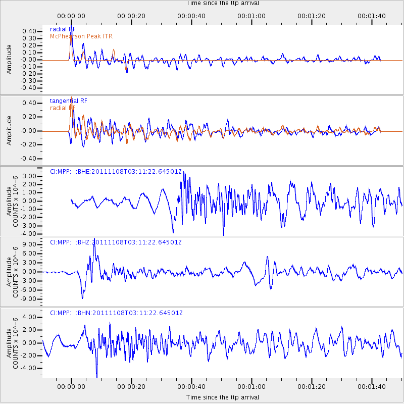
MPP McPhearson Peak - Earthquake Result Viewer
*The percent match for this event was below the threshold and hence no stack was calculated.
| Earthquake location: |
Northeast Of Taiwan |
| Earthquake latitude/longitude: |
27.3/125.6 |
| Earthquake time(UTC): |
2011/11/08 (312) 02:59:08 GMT |
| Earthquake Depth: |
225 km |
| Earthquake Magnitude: |
6.5 MB, 6.9 MW, 6.9 MW |
| Earthquake Catalog/Contributor: |
WHDF/NEIC |
|
| Network: |
CI Caltech Regional Seismic Network |
| Station: |
MPP McPhearson Peak |
| Lat/Lon: |
34.89 N/119.81 W |
| Elevation: |
1739 m |
|
| Distance: |
92.5 deg |
| Az: |
48.451 deg |
| Baz: |
305.91 deg |
| Ray Param: |
$rayparam |
*The percent match for this event was below the threshold and hence was not used in the summary stack. |
|
| Radial Match: |
69.243866 % |
| Radial Bump: |
400 |
| Transverse Match: |
65.71319 % |
| Transverse Bump: |
400 |
| SOD ConfigId: |
424168 |
| Insert Time: |
2012-02-24 06:13:47.601 +0000 |
| GWidth: |
2.5 |
| Max Bumps: |
400 |
| Tol: |
0.001 |
|
Signal To Noise
| Channel | StoN | STA | LTA |
| CI:MPP: :BHZ:20111108T03:11:22.64501Z | 10.696912 | 3.4030802E-6 | 3.181367E-7 |
| CI:MPP: :BHN:20111108T03:11:22.64501Z | 1.0871601 | 1.129763E-6 | 1.0391873E-6 |
| CI:MPP: :BHE:20111108T03:11:22.64501Z | 3.687387 | 1.6148001E-6 | 4.379253E-7 |
| Arrivals |
| Ps | |
| PpPs | |
| PsPs/PpSs | |


