You are here: Home > Network List > TA - USArray Transportable Network (new EarthScope stations) Stations List
> Station E31A Nome, ND, USA > Earthquake Result Viewer
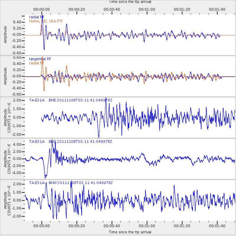
E31A Nome, ND, USA - Earthquake Result Viewer
*The percent match for this event was below the threshold and hence no stack was calculated.
| Earthquake location: |
Northeast Of Taiwan |
| Earthquake latitude/longitude: |
27.3/125.6 |
| Earthquake time(UTC): |
2011/11/08 (312) 02:59:08 GMT |
| Earthquake Depth: |
225 km |
| Earthquake Magnitude: |
6.5 MB, 6.9 MW, 6.9 MW |
| Earthquake Catalog/Contributor: |
WHDF/NEIC |
|
| Network: |
TA USArray Transportable Network (new EarthScope stations) |
| Station: |
E31A Nome, ND, USA |
| Lat/Lon: |
46.56 N/97.89 W |
| Elevation: |
427 m |
|
| Distance: |
96.6 deg |
| Az: |
28.57 deg |
| Baz: |
321.933 deg |
| Ray Param: |
$rayparam |
*The percent match for this event was below the threshold and hence was not used in the summary stack. |
|
| Radial Match: |
78.86866 % |
| Radial Bump: |
400 |
| Transverse Match: |
62.24874 % |
| Transverse Bump: |
400 |
| SOD ConfigId: |
424168 |
| Insert Time: |
2012-02-24 06:25:36.849 +0000 |
| GWidth: |
2.5 |
| Max Bumps: |
400 |
| Tol: |
0.001 |
|
Signal To Noise
| Channel | StoN | STA | LTA |
| TA:E31A: :BHZ:20111108T03:11:41.049978Z | 11.671511 | 2.6886985E-6 | 2.3036424E-7 |
| TA:E31A: :BHN:20111108T03:11:41.049978Z | 2.1395059 | 9.69149E-7 | 4.52978E-7 |
| TA:E31A: :BHE:20111108T03:11:41.049978Z | 2.9631104 | 8.741226E-7 | 2.9500168E-7 |
| Arrivals |
| Ps | |
| PpPs | |
| PsPs/PpSs | |


