You are here: Home > Network List > UW - Pacific Northwest Regional Seismic Network Stations List
> Station TAKO Tahkenitch, OR CREST BB SMO > Earthquake Result Viewer
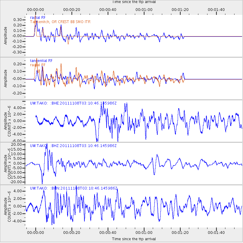
TAKO Tahkenitch, OR CREST BB SMO - Earthquake Result Viewer
*The percent match for this event was below the threshold and hence no stack was calculated.
| Earthquake location: |
Northeast Of Taiwan |
| Earthquake latitude/longitude: |
27.3/125.6 |
| Earthquake time(UTC): |
2011/11/08 (312) 02:59:08 GMT |
| Earthquake Depth: |
225 km |
| Earthquake Magnitude: |
6.5 MB, 6.9 MW, 6.9 MW |
| Earthquake Catalog/Contributor: |
WHDF/NEIC |
|
| Network: |
UW Pacific Northwest Regional Seismic Network |
| Station: |
TAKO Tahkenitch, OR CREST BB SMO |
| Lat/Lon: |
43.74 N/124.08 W |
| Elevation: |
46 m |
|
| Distance: |
84.8 deg |
| Az: |
43.046 deg |
| Baz: |
303.08 deg |
| Ray Param: |
$rayparam |
*The percent match for this event was below the threshold and hence was not used in the summary stack. |
|
| Radial Match: |
77.159294 % |
| Radial Bump: |
400 |
| Transverse Match: |
70.26715 % |
| Transverse Bump: |
400 |
| SOD ConfigId: |
424168 |
| Insert Time: |
2012-02-24 06:29:16.017 +0000 |
| GWidth: |
2.5 |
| Max Bumps: |
400 |
| Tol: |
0.001 |
|
Signal To Noise
| Channel | StoN | STA | LTA |
| UW:TAKO: :BHZ:20111108T03:10:46.145986Z | 6.5343156 | 7.488591E-6 | 1.1460406E-6 |
| UW:TAKO: :BHN:20111108T03:10:46.145986Z | 2.437898 | 1.7672111E-6 | 7.248913E-7 |
| UW:TAKO: :BHE:20111108T03:10:46.145986Z | 3.2112288 | 2.7987667E-6 | 8.715563E-7 |
| Arrivals |
| Ps | |
| PpPs | |
| PsPs/PpSs | |


