You are here: Home > Network List > TA - USArray Transportable Network (new EarthScope stations) Stations List
> Station R58B Mineral, VA, USA > Earthquake Result Viewer
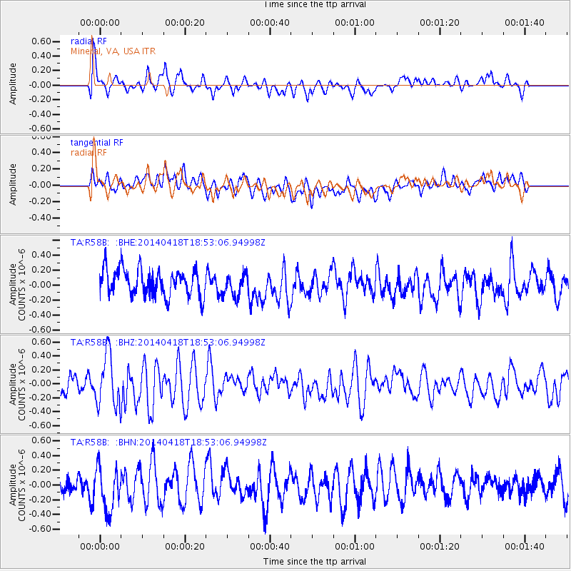
R58B Mineral, VA, USA - Earthquake Result Viewer
*The percent match for this event was below the threshold and hence no stack was calculated.
| Earthquake location: |
Northern Alaska |
| Earthquake latitude/longitude: |
67.7/-162.5 |
| Earthquake time(UTC): |
2014/04/18 (108) 18:44:17 GMT |
| Earthquake Depth: |
1.0 km |
| Earthquake Magnitude: |
5.5 MB, 5.4 MI |
| Earthquake Catalog/Contributor: |
NEIC PDE/NEIC COMCAT |
|
| Network: |
TA USArray Transportable Network (new EarthScope stations) |
| Station: |
R58B Mineral, VA, USA |
| Lat/Lon: |
37.96 N/77.88 W |
| Elevation: |
116 m |
|
| Distance: |
53.5 deg |
| Az: |
78.125 deg |
| Baz: |
331.762 deg |
| Ray Param: |
$rayparam |
*The percent match for this event was below the threshold and hence was not used in the summary stack. |
|
| Radial Match: |
65.891495 % |
| Radial Bump: |
400 |
| Transverse Match: |
56.745 % |
| Transverse Bump: |
400 |
| SOD ConfigId: |
3390531 |
| Insert Time: |
2019-04-11 11:29:55.484 +0000 |
| GWidth: |
2.5 |
| Max Bumps: |
400 |
| Tol: |
0.001 |
|
Signal To Noise
| Channel | StoN | STA | LTA |
| TA:R58B: :BHZ:20140418T18:53:06.94998Z | 2.0164874 | 3.7902717E-7 | 1.8796409E-7 |
| TA:R58B: :BHN:20140418T18:53:06.94998Z | 1.3479201 | 3.0670765E-7 | 2.2754143E-7 |
| TA:R58B: :BHE:20140418T18:53:06.94998Z | 1.11228 | 1.8792157E-7 | 1.6895167E-7 |
| Arrivals |
| Ps | |
| PpPs | |
| PsPs/PpSs | |


