You are here: Home > Network List > TA - USArray Transportable Network (new EarthScope stations) Stations List
> Station L39A Vinton, IA, USA > Earthquake Result Viewer
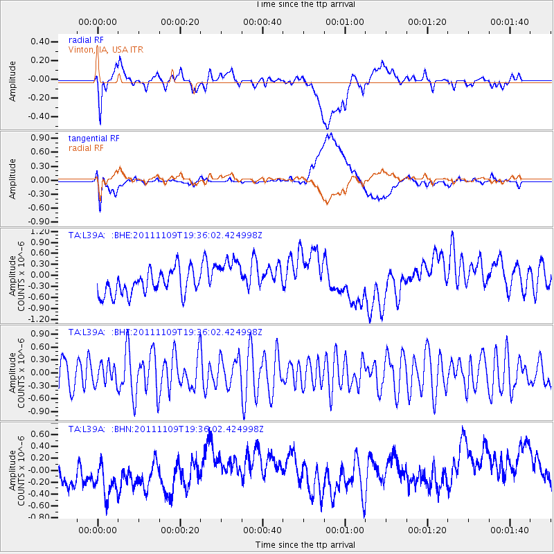
L39A Vinton, IA, USA - Earthquake Result Viewer
*The percent match for this event was below the threshold and hence no stack was calculated.
| Earthquake location: |
Turkey |
| Earthquake latitude/longitude: |
38.4/43.2 |
| Earthquake time(UTC): |
2011/11/09 (313) 19:23:33 GMT |
| Earthquake Depth: |
5.0 km |
| Earthquake Magnitude: |
5.6 MB, 5.6 MS, 5.6 MW, 5.6 MW |
| Earthquake Catalog/Contributor: |
WHDF/NEIC |
|
| Network: |
TA USArray Transportable Network (new EarthScope stations) |
| Station: |
L39A Vinton, IA, USA |
| Lat/Lon: |
42.12 N/92.00 W |
| Elevation: |
261 m |
|
| Distance: |
90.1 deg |
| Az: |
328.404 deg |
| Baz: |
33.582 deg |
| Ray Param: |
$rayparam |
*The percent match for this event was below the threshold and hence was not used in the summary stack. |
|
| Radial Match: |
35.009556 % |
| Radial Bump: |
400 |
| Transverse Match: |
28.097307 % |
| Transverse Bump: |
400 |
| SOD ConfigId: |
424168 |
| Insert Time: |
2012-02-24 06:48:07.078 +0000 |
| GWidth: |
2.5 |
| Max Bumps: |
400 |
| Tol: |
0.001 |
|
Signal To Noise
| Channel | StoN | STA | LTA |
| TA:L39A: :BHZ:20111109T19:36:02.424998Z | 0.79610604 | 2.3532918E-7 | 2.956003E-7 |
| TA:L39A: :BHN:20111109T19:36:02.424998Z | 0.98821104 | 6.448091E-7 | 6.525014E-7 |
| TA:L39A: :BHE:20111109T19:36:02.424998Z | 1.7348686 | 5.6204647E-7 | 3.2397062E-7 |
| Arrivals |
| Ps | |
| PpPs | |
| PsPs/PpSs | |


