You are here: Home > Network List > CI - Caltech Regional Seismic Network Stations List
> Station RCT Rector, Visalia, CA, USA > Earthquake Result Viewer
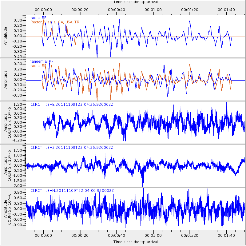
RCT Rector, Visalia, CA, USA - Earthquake Result Viewer
*The percent match for this event was below the threshold and hence no stack was calculated.
| Earthquake location: |
E. Caroline Islands, Micronesia |
| Earthquake latitude/longitude: |
10.5/146.1 |
| Earthquake time(UTC): |
2011/11/09 (313) 21:52:20 GMT |
| Earthquake Depth: |
10 km |
| Earthquake Magnitude: |
5.6 MB, 5.4 MS, 5.7 MW, 5.5 MW |
| Earthquake Catalog/Contributor: |
WHDF/NEIC |
|
| Network: |
CI Caltech Regional Seismic Network |
| Station: |
RCT Rector, Visalia, CA, USA |
| Lat/Lon: |
36.31 N/119.24 W |
| Elevation: |
107 m |
|
| Distance: |
87.6 deg |
| Az: |
53.69 deg |
| Baz: |
281.193 deg |
| Ray Param: |
$rayparam |
*The percent match for this event was below the threshold and hence was not used in the summary stack. |
|
| Radial Match: |
54.468643 % |
| Radial Bump: |
400 |
| Transverse Match: |
62.850662 % |
| Transverse Bump: |
400 |
| SOD ConfigId: |
424168 |
| Insert Time: |
2012-02-24 06:57:42.460 +0000 |
| GWidth: |
2.5 |
| Max Bumps: |
400 |
| Tol: |
0.001 |
|
Signal To Noise
| Channel | StoN | STA | LTA |
| CI:RCT: :BHZ:20111109T22:04:36.920002Z | 1.2993865 | 2.557257E-7 | 1.9680495E-7 |
| CI:RCT: :BHN:20111109T22:04:36.920002Z | 0.8691057 | 2.6871732E-7 | 3.0918832E-7 |
| CI:RCT: :BHE:20111109T22:04:36.920002Z | 1.0176774 | 3.3725408E-7 | 3.3139585E-7 |
| Arrivals |
| Ps | |
| PpPs | |
| PsPs/PpSs | |


