You are here: Home > Network List > UW - Pacific Northwest Regional Seismic Network Stations List
> Station YACT Amboy, WA, USA > Earthquake Result Viewer
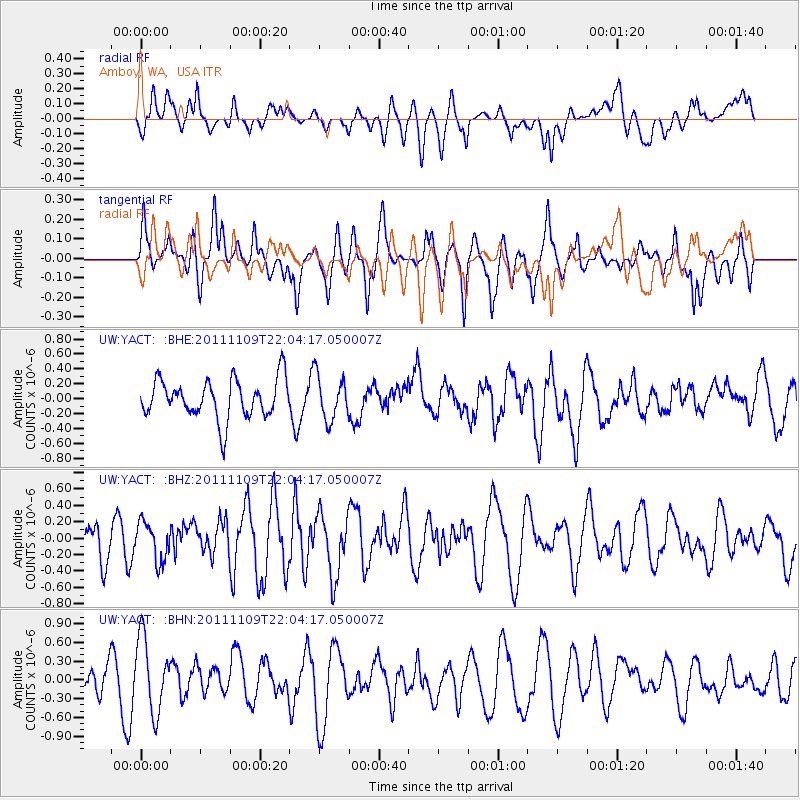
YACT Amboy, WA, USA - Earthquake Result Viewer
*The percent match for this event was below the threshold and hence no stack was calculated.
| Earthquake location: |
E. Caroline Islands, Micronesia |
| Earthquake latitude/longitude: |
10.5/146.1 |
| Earthquake time(UTC): |
2011/11/09 (313) 21:52:20 GMT |
| Earthquake Depth: |
10 km |
| Earthquake Magnitude: |
5.6 MB, 5.4 MS, 5.7 MW, 5.5 MW |
| Earthquake Catalog/Contributor: |
WHDF/NEIC |
|
| Network: |
UW Pacific Northwest Regional Seismic Network |
| Station: |
YACT Amboy, WA, USA |
| Lat/Lon: |
45.93 N/122.42 W |
| Elevation: |
211 m |
|
| Distance: |
83.5 deg |
| Az: |
44.598 deg |
| Baz: |
278.398 deg |
| Ray Param: |
$rayparam |
*The percent match for this event was below the threshold and hence was not used in the summary stack. |
|
| Radial Match: |
44.885532 % |
| Radial Bump: |
400 |
| Transverse Match: |
46.346756 % |
| Transverse Bump: |
392 |
| SOD ConfigId: |
424168 |
| Insert Time: |
2012-02-24 07:02:51.116 +0000 |
| GWidth: |
2.5 |
| Max Bumps: |
400 |
| Tol: |
0.001 |
|
Signal To Noise
| Channel | StoN | STA | LTA |
| UW:YACT: :BHZ:20111109T22:04:17.050007Z | 1.3080636 | 2.3254513E-7 | 1.7777816E-7 |
| UW:YACT: :BHN:20111109T22:04:17.050007Z | 3.2974148 | 5.907653E-7 | 1.7916012E-7 |
| UW:YACT: :BHE:20111109T22:04:17.050007Z | 1.124362 | 2.9466304E-7 | 2.6207132E-7 |
| Arrivals |
| Ps | |
| PpPs | |
| PsPs/PpSs | |


