You are here: Home > Network List > AZ - ANZA Regional Network Stations List
> Station SMER AZ.SMER > Earthquake Result Viewer
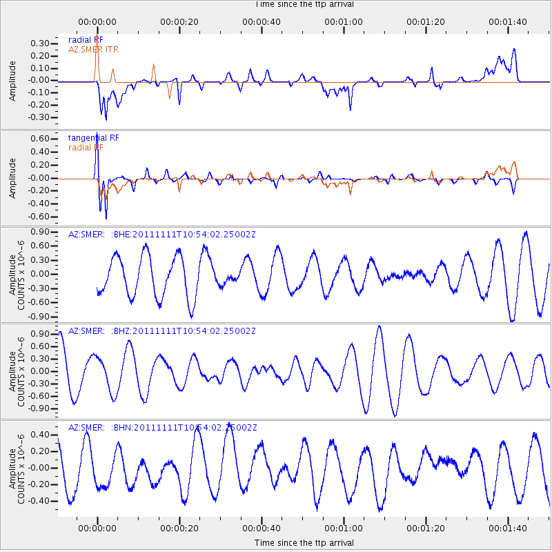
SMER AZ.SMER - Earthquake Result Viewer
*The percent match for this event was below the threshold and hence no stack was calculated.
| Earthquake location: |
Southern East Pacific Rise |
| Earthquake latitude/longitude: |
-56.0/-124.4 |
| Earthquake time(UTC): |
2011/11/11 (315) 10:41:37 GMT |
| Earthquake Depth: |
10 km |
| Earthquake Magnitude: |
5.6 MS, 5.1 MB, 6.0 MW, 6.1 MW |
| Earthquake Catalog/Contributor: |
WHDF/NEIC |
|
| Network: |
AZ ANZA Regional Network |
| Station: |
SMER AZ.SMER |
| Lat/Lon: |
33.46 N/117.17 W |
| Elevation: |
355 m |
|
| Distance: |
89.3 deg |
| Az: |
6.072 deg |
| Baz: |
184.078 deg |
| Ray Param: |
$rayparam |
*The percent match for this event was below the threshold and hence was not used in the summary stack. |
|
| Radial Match: |
41.97272 % |
| Radial Bump: |
400 |
| Transverse Match: |
89.22859 % |
| Transverse Bump: |
400 |
| SOD ConfigId: |
424168 |
| Insert Time: |
2012-02-24 07:08:07.473 +0000 |
| GWidth: |
2.5 |
| Max Bumps: |
400 |
| Tol: |
0.001 |
|
Signal To Noise
| Channel | StoN | STA | LTA |
| AZ:SMER: :BHZ:20111111T10:54:02.25002Z | 0.7889746 | 4.267262E-7 | 5.408618E-7 |
| AZ:SMER: :BHN:20111111T10:54:02.25002Z | 0.76843524 | 2.1192979E-7 | 2.7579395E-7 |
| AZ:SMER: :BHE:20111111T10:54:02.25002Z | 0.24654579 | 1.0315766E-7 | 4.1841176E-7 |
| Arrivals |
| Ps | |
| PpPs | |
| PsPs/PpSs | |


