You are here: Home > Network List > CI - Caltech Regional Seismic Network Stations List
> Station SHO Shoshone, CA, USA > Earthquake Result Viewer
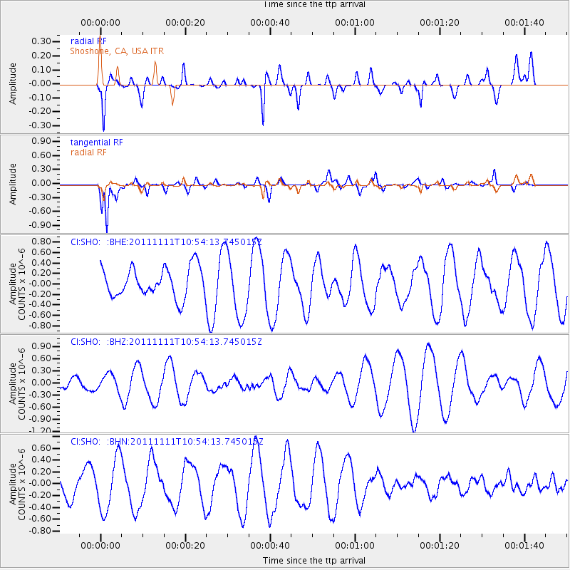
SHO Shoshone, CA, USA - Earthquake Result Viewer
*The percent match for this event was below the threshold and hence no stack was calculated.
| Earthquake location: |
Southern East Pacific Rise |
| Earthquake latitude/longitude: |
-56.0/-124.4 |
| Earthquake time(UTC): |
2011/11/11 (315) 10:41:37 GMT |
| Earthquake Depth: |
10 km |
| Earthquake Magnitude: |
5.6 MS, 5.1 MB, 6.0 MW, 6.1 MW |
| Earthquake Catalog/Contributor: |
WHDF/NEIC |
|
| Network: |
CI Caltech Regional Seismic Network |
| Station: |
SHO Shoshone, CA, USA |
| Lat/Lon: |
35.90 N/116.28 W |
| Elevation: |
451 m |
|
| Distance: |
91.8 deg |
| Az: |
6.624 deg |
| Baz: |
184.58 deg |
| Ray Param: |
$rayparam |
*The percent match for this event was below the threshold and hence was not used in the summary stack. |
|
| Radial Match: |
37.022247 % |
| Radial Bump: |
364 |
| Transverse Match: |
70.12798 % |
| Transverse Bump: |
312 |
| SOD ConfigId: |
424168 |
| Insert Time: |
2012-02-24 07:08:44.428 +0000 |
| GWidth: |
2.5 |
| Max Bumps: |
400 |
| Tol: |
0.001 |
|
Signal To Noise
| Channel | StoN | STA | LTA |
| CI:SHO: :BHZ:20111111T10:54:13.745015Z | 0.86451435 | 2.1256011E-7 | 2.4587226E-7 |
| CI:SHO: :BHN:20111111T10:54:13.745015Z | 1.9887389 | 4.5286637E-7 | 2.2771535E-7 |
| CI:SHO: :BHE:20111111T10:54:13.745015Z | 2.2197723 | 6.186455E-7 | 2.7869774E-7 |
| Arrivals |
| Ps | |
| PpPs | |
| PsPs/PpSs | |


