You are here: Home > Network List > G - GEOSCOPE Stations List
> Station FOMA Nahampoana reservation, Fort Dauphin, Madagascar > Earthquake Result Viewer
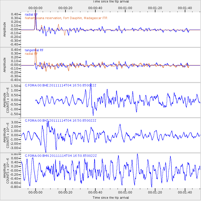
FOMA Nahampoana reservation, Fort Dauphin, Madagascar - Earthquake Result Viewer
*The percent match for this event was below the threshold and hence no stack was calculated.
| Earthquake location: |
Southern Molucca Sea |
| Earthquake latitude/longitude: |
-0.9/126.9 |
| Earthquake time(UTC): |
2011/11/14 (318) 04:05:11 GMT |
| Earthquake Depth: |
17 km |
| Earthquake Magnitude: |
6.2 MB, 6.2 MS, 6.3 MW, 6.3 MW |
| Earthquake Catalog/Contributor: |
WHDF/NEIC |
|
| Network: |
G GEOSCOPE |
| Station: |
FOMA Nahampoana reservation, Fort Dauphin, Madagascar |
| Lat/Lon: |
24.98 S/46.98 E |
| Elevation: |
26 m |
|
| Distance: |
80.5 deg |
| Az: |
244.971 deg |
| Baz: |
86.601 deg |
| Ray Param: |
$rayparam |
*The percent match for this event was below the threshold and hence was not used in the summary stack. |
|
| Radial Match: |
76.23355 % |
| Radial Bump: |
400 |
| Transverse Match: |
62.23897 % |
| Transverse Bump: |
400 |
| SOD ConfigId: |
432046 |
| Insert Time: |
2012-02-28 05:42:51.958 +0000 |
| GWidth: |
2.5 |
| Max Bumps: |
400 |
| Tol: |
0.001 |
|
Signal To Noise
| Channel | StoN | STA | LTA |
| G:FOMA:00:BHZ:20111114T04:16:50.850022Z | 3.1376166 | 1.1242752E-6 | 3.583214E-7 |
| G:FOMA:00:BHN:20111114T04:16:50.850022Z | 1.1161824 | 3.0589788E-7 | 2.7405724E-7 |
| G:FOMA:00:BHE:20111114T04:16:50.850022Z | 1.7569219 | 4.767175E-7 | 2.7133677E-7 |
| Arrivals |
| Ps | |
| PpPs | |
| PsPs/PpSs | |


