You are here: Home > Network List > IC - New China Digital Seismograph Network Stations List
> Station LSA Tibet, China > Earthquake Result Viewer
LSA Tibet, China - Earthquake Result Viewer
*The percent match for this event was below the threshold and hence no stack was calculated.
| Earthquake location: |
Minahassa Peninsula, Sulawesi |
| Earthquake latitude/longitude: |
-0.1/121.9 |
| Earthquake time(UTC): |
2011/11/15 (319) 10:43:51 GMT |
| Earthquake Depth: |
276 km |
| Earthquake Magnitude: |
5.7 MB, 5.7 MW, 5.8 MW |
| Earthquake Catalog/Contributor: |
WHDF/NEIC |
|
| Network: |
IC New China Digital Seismograph Network |
| Station: |
LSA Tibet, China |
| Lat/Lon: |
29.70 N/91.13 E |
| Elevation: |
3660 m |
|
| Distance: |
41.7 deg |
| Az: |
317.98 deg |
| Baz: |
129.701 deg |
| Ray Param: |
$rayparam |
*The percent match for this event was below the threshold and hence was not used in the summary stack. |
|
| Radial Match: |
29.848053 % |
| Radial Bump: |
400 |
| Transverse Match: |
29.399036 % |
| Transverse Bump: |
400 |
| SOD ConfigId: |
432046 |
| Insert Time: |
2012-02-28 05:56:05.520 +0000 |
| GWidth: |
2.5 |
| Max Bumps: |
400 |
| Tol: |
0.001 |
|
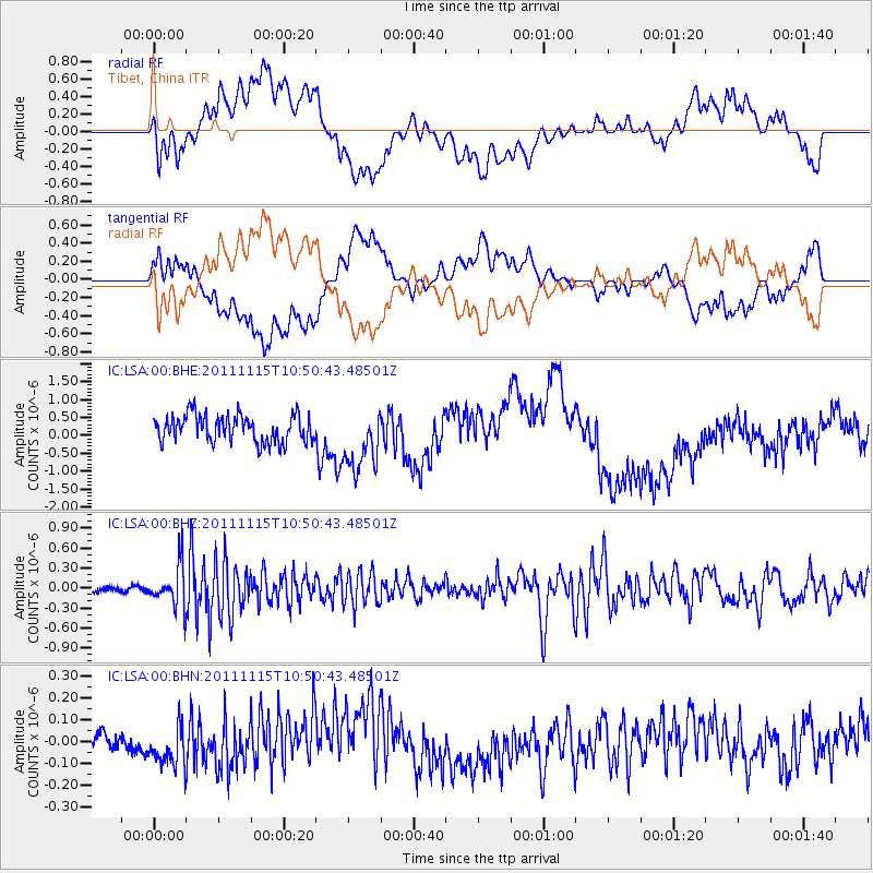
Signal To Noise
| Channel | StoN | STA | LTA |
| IC:LSA:00:BHZ:20111115T10:50:43.48501Z | 7.4301095 | 3.1813806E-7 | 4.2817415E-8 |
| IC:LSA:00:BHN:20111115T10:50:43.48501Z | 3.3796873 | 1.01239145E-7 | 2.9955178E-8 |
| IC:LSA:00:BHE:20111115T10:50:43.48501Z | 2.355556 | 8.8928374E-7 | 3.7752602E-7 |
| Arrivals |
| Ps | |
| PpPs | |
| PsPs/PpSs | |


