You are here: Home > Network List > TA - USArray Transportable Network (new EarthScope stations) Stations List
> Station BGNE Belgrade, NE, USA > Earthquake Result Viewer
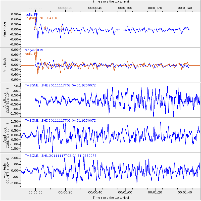
BGNE Belgrade, NE, USA - Earthquake Result Viewer
*The percent match for this event was below the threshold and hence no stack was calculated.
| Earthquake location: |
Off Coast Of Ecuador |
| Earthquake latitude/longitude: |
-1.7/-81.5 |
| Earthquake time(UTC): |
2011/11/17 (321) 01:57:05 GMT |
| Earthquake Depth: |
27 km |
| Earthquake Magnitude: |
5.7 MB, 5.6 MS, 6.0 MW, 5.9 MW |
| Earthquake Catalog/Contributor: |
WHDF/NEIC |
|
| Network: |
TA USArray Transportable Network (new EarthScope stations) |
| Station: |
BGNE Belgrade, NE, USA |
| Lat/Lon: |
41.41 N/98.15 W |
| Elevation: |
573 m |
|
| Distance: |
45.5 deg |
| Az: |
342.456 deg |
| Baz: |
156.386 deg |
| Ray Param: |
$rayparam |
*The percent match for this event was below the threshold and hence was not used in the summary stack. |
|
| Radial Match: |
77.63493 % |
| Radial Bump: |
400 |
| Transverse Match: |
66.22998 % |
| Transverse Bump: |
400 |
| SOD ConfigId: |
432046 |
| Insert Time: |
2012-02-28 06:22:46.787 +0000 |
| GWidth: |
2.5 |
| Max Bumps: |
400 |
| Tol: |
0.001 |
|
Signal To Noise
| Channel | StoN | STA | LTA |
| TA:BGNE: :BHZ:20111117T02:04:51.925007Z | 3.4494112 | 6.355247E-7 | 1.8424151E-7 |
| TA:BGNE: :BHN:20111117T02:04:51.925007Z | 2.5545793 | 6.151964E-7 | 2.4082104E-7 |
| TA:BGNE: :BHE:20111117T02:04:51.925007Z | 1.3315492 | 3.6282444E-7 | 2.7248294E-7 |
| Arrivals |
| Ps | |
| PpPs | |
| PsPs/PpSs | |


