You are here: Home > Network List > TA - USArray Transportable Network (new EarthScope stations) Stations List
> Station 833A Chaparral WMA, Artesia Wells, TX, USA > Earthquake Result Viewer
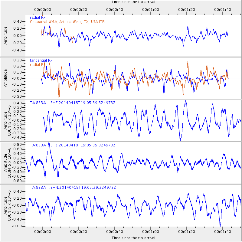
833A Chaparral WMA, Artesia Wells, TX, USA - Earthquake Result Viewer
*The percent match for this event was below the threshold and hence no stack was calculated.
| Earthquake location: |
Northern Alaska |
| Earthquake latitude/longitude: |
67.7/-162.5 |
| Earthquake time(UTC): |
2014/04/18 (108) 18:56:47 GMT |
| Earthquake Depth: |
17 km |
| Earthquake Magnitude: |
5.7 MW |
| Earthquake Catalog/Contributor: |
ISC/ISC |
|
| Network: |
TA USArray Transportable Network (new EarthScope stations) |
| Station: |
833A Chaparral WMA, Artesia Wells, TX, USA |
| Lat/Lon: |
28.32 N/99.39 W |
| Elevation: |
171 m |
|
| Distance: |
54.0 deg |
| Az: |
103.482 deg |
| Baz: |
335.111 deg |
| Ray Param: |
$rayparam |
*The percent match for this event was below the threshold and hence was not used in the summary stack. |
|
| Radial Match: |
64.9239 % |
| Radial Bump: |
400 |
| Transverse Match: |
55.669296 % |
| Transverse Bump: |
333 |
| SOD ConfigId: |
3390531 |
| Insert Time: |
2019-04-11 11:38:44.060 +0000 |
| GWidth: |
2.5 |
| Max Bumps: |
400 |
| Tol: |
0.001 |
|
Signal To Noise
| Channel | StoN | STA | LTA |
| TA:833A: :BHZ:20140418T19:05:39.324973Z | 3.0717967 | 4.6942043E-7 | 1.5281624E-7 |
| TA:833A: :BHN:20140418T19:05:39.324973Z | 1.0374188 | 1.7508094E-7 | 1.6876592E-7 |
| TA:833A: :BHE:20140418T19:05:39.324973Z | 1.2658489 | 2.1331634E-7 | 1.6851644E-7 |
| Arrivals |
| Ps | |
| PpPs | |
| PsPs/PpSs | |


