You are here: Home > Network List > TA - USArray Transportable Network (new EarthScope stations) Stations List
> Station J49A Marlette, MI, USA > Earthquake Result Viewer
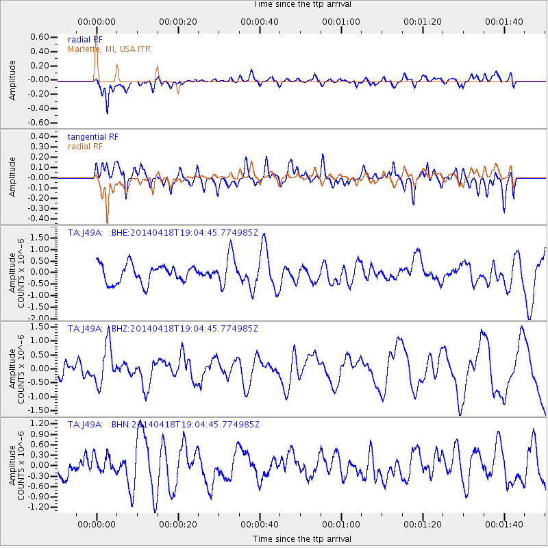
J49A Marlette, MI, USA - Earthquake Result Viewer
*The percent match for this event was below the threshold and hence no stack was calculated.
| Earthquake location: |
Northern Alaska |
| Earthquake latitude/longitude: |
67.7/-162.5 |
| Earthquake time(UTC): |
2014/04/18 (108) 18:56:47 GMT |
| Earthquake Depth: |
17 km |
| Earthquake Magnitude: |
5.7 MW |
| Earthquake Catalog/Contributor: |
ISC/ISC |
|
| Network: |
TA USArray Transportable Network (new EarthScope stations) |
| Station: |
J49A Marlette, MI, USA |
| Lat/Lon: |
43.36 N/83.14 W |
| Elevation: |
253 m |
|
| Distance: |
46.9 deg |
| Az: |
79.212 deg |
| Baz: |
329.077 deg |
| Ray Param: |
$rayparam |
*The percent match for this event was below the threshold and hence was not used in the summary stack. |
|
| Radial Match: |
70.29619 % |
| Radial Bump: |
400 |
| Transverse Match: |
43.86722 % |
| Transverse Bump: |
400 |
| SOD ConfigId: |
3390531 |
| Insert Time: |
2019-04-11 11:39:19.766 +0000 |
| GWidth: |
2.5 |
| Max Bumps: |
400 |
| Tol: |
0.001 |
|
Signal To Noise
| Channel | StoN | STA | LTA |
| TA:J49A: :BHZ:20140418T19:04:45.774985Z | 1.8174312 | 7.221285E-7 | 3.9733473E-7 |
| TA:J49A: :BHN:20140418T19:04:45.774985Z | 0.7865707 | 2.5599576E-7 | 3.2545802E-7 |
| TA:J49A: :BHE:20140418T19:04:45.774985Z | 1.7565012 | 6.840722E-7 | 3.8945157E-7 |
| Arrivals |
| Ps | |
| PpPs | |
| PsPs/PpSs | |


