You are here: Home > Network List > TA - USArray Transportable Network (new EarthScope stations) Stations List
> Station R41A Rosebud, MO, USA > Earthquake Result Viewer
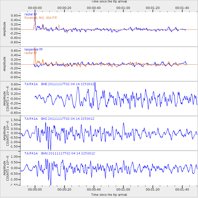
R41A Rosebud, MO, USA - Earthquake Result Viewer
*The percent match for this event was below the threshold and hence no stack was calculated.
| Earthquake location: |
Off Coast Of Ecuador |
| Earthquake latitude/longitude: |
-1.7/-81.5 |
| Earthquake time(UTC): |
2011/11/17 (321) 01:57:05 GMT |
| Earthquake Depth: |
27 km |
| Earthquake Magnitude: |
5.7 MB, 5.6 MS, 6.0 MW, 5.9 MW |
| Earthquake Catalog/Contributor: |
WHDF/NEIC |
|
| Network: |
TA USArray Transportable Network (new EarthScope stations) |
| Station: |
R41A Rosebud, MO, USA |
| Lat/Lon: |
38.30 N/91.38 W |
| Elevation: |
257 m |
|
| Distance: |
40.8 deg |
| Az: |
348.138 deg |
| Baz: |
164.863 deg |
| Ray Param: |
$rayparam |
*The percent match for this event was below the threshold and hence was not used in the summary stack. |
|
| Radial Match: |
60.07112 % |
| Radial Bump: |
400 |
| Transverse Match: |
47.383255 % |
| Transverse Bump: |
400 |
| SOD ConfigId: |
432046 |
| Insert Time: |
2012-02-28 06:45:09.351 +0000 |
| GWidth: |
2.5 |
| Max Bumps: |
400 |
| Tol: |
0.001 |
|
Signal To Noise
| Channel | StoN | STA | LTA |
| TA:R41A: :BHZ:20111117T02:04:14.325001Z | 3.0797434 | 5.196832E-7 | 1.6874237E-7 |
| TA:R41A: :BHN:20111117T02:04:14.325001Z | 1.618647 | 3.077859E-7 | 1.9015013E-7 |
| TA:R41A: :BHE:20111117T02:04:14.325001Z | 1.9011533 | 2.3933268E-7 | 1.2588815E-7 |
| Arrivals |
| Ps | |
| PpPs | |
| PsPs/PpSs | |


