You are here: Home > Network List > AZ - ANZA Regional Network Stations List
> Station LVA2 AZ.LVA2 > Earthquake Result Viewer
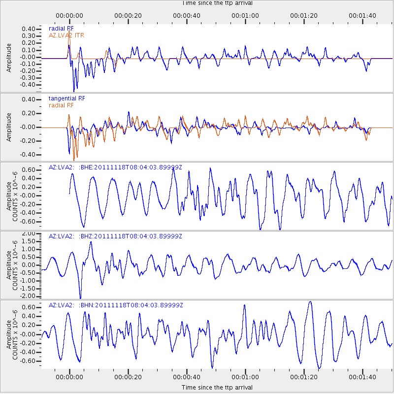
LVA2 AZ.LVA2 - Earthquake Result Viewer
*The percent match for this event was below the threshold and hence no stack was calculated.
| Earthquake location: |
Off E. Coast Of N. Island, N.Z. |
| Earthquake latitude/longitude: |
-37.8/179.4 |
| Earthquake time(UTC): |
2011/11/18 (322) 07:51:24 GMT |
| Earthquake Depth: |
12 km |
| Earthquake Magnitude: |
5.8 MB, 5.6 MS, 5.8 MW, 5.7 MW |
| Earthquake Catalog/Contributor: |
WHDF/NEIC |
|
| Network: |
AZ ANZA Regional Network |
| Station: |
LVA2 AZ.LVA2 |
| Lat/Lon: |
33.35 N/116.56 W |
| Elevation: |
1435 m |
|
| Distance: |
92.5 deg |
| Az: |
48.863 deg |
| Baz: |
225.457 deg |
| Ray Param: |
$rayparam |
*The percent match for this event was below the threshold and hence was not used in the summary stack. |
|
| Radial Match: |
65.84648 % |
| Radial Bump: |
400 |
| Transverse Match: |
59.3259 % |
| Transverse Bump: |
400 |
| SOD ConfigId: |
432046 |
| Insert Time: |
2012-02-28 07:08:47.699 +0000 |
| GWidth: |
2.5 |
| Max Bumps: |
400 |
| Tol: |
0.001 |
|
Signal To Noise
| Channel | StoN | STA | LTA |
| AZ:LVA2: :BHZ:20111118T08:04:03.89999Z | 3.853277 | 8.499093E-7 | 2.2056794E-7 |
| AZ:LVA2: :BHN:20111118T08:04:03.89999Z | 1.064745 | 3.9348907E-7 | 3.6956183E-7 |
| AZ:LVA2: :BHE:20111118T08:04:03.89999Z | 0.6537141 | 2.131742E-7 | 3.26097E-7 |
| Arrivals |
| Ps | |
| PpPs | |
| PsPs/PpSs | |


