You are here: Home > Network List > G - GEOSCOPE Stations List
> Station INU Inuyama, Japan > Earthquake Result Viewer
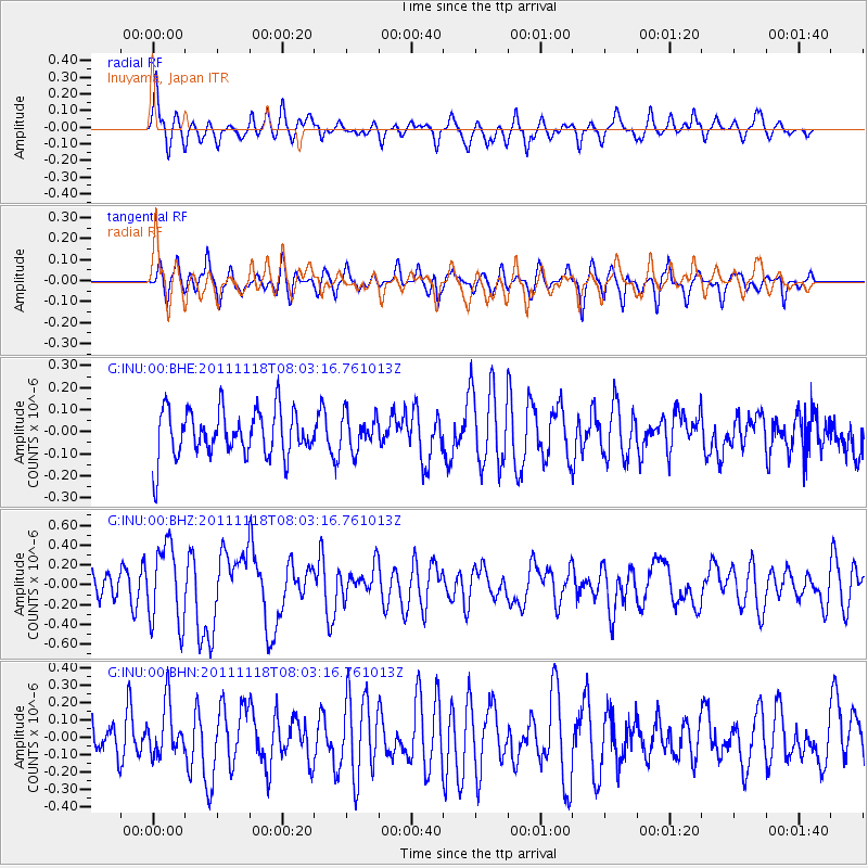
INU Inuyama, Japan - Earthquake Result Viewer
*The percent match for this event was below the threshold and hence no stack was calculated.
| Earthquake location: |
Off E. Coast Of N. Island, N.Z. |
| Earthquake latitude/longitude: |
-37.8/179.4 |
| Earthquake time(UTC): |
2011/11/18 (322) 07:51:24 GMT |
| Earthquake Depth: |
12 km |
| Earthquake Magnitude: |
5.8 MB, 5.6 MS, 5.8 MW, 5.7 MW |
| Earthquake Catalog/Contributor: |
WHDF/NEIC |
|
| Network: |
G GEOSCOPE |
| Station: |
INU Inuyama, Japan |
| Lat/Lon: |
35.35 N/137.03 E |
| Elevation: |
132 m |
|
| Distance: |
82.7 deg |
| Az: |
326.25 deg |
| Baz: |
147.43 deg |
| Ray Param: |
$rayparam |
*The percent match for this event was below the threshold and hence was not used in the summary stack. |
|
| Radial Match: |
64.63285 % |
| Radial Bump: |
338 |
| Transverse Match: |
62.18114 % |
| Transverse Bump: |
360 |
| SOD ConfigId: |
432046 |
| Insert Time: |
2012-02-28 07:11:18.307 +0000 |
| GWidth: |
2.5 |
| Max Bumps: |
400 |
| Tol: |
0.001 |
|
Signal To Noise
| Channel | StoN | STA | LTA |
| G:INU:00:BHZ:20111118T08:03:16.761013Z | 4.0080037 | 3.9529462E-7 | 9.862631E-8 |
| G:INU:00:BHN:20111118T08:03:16.761013Z | 0.76509005 | 1.4969488E-7 | 1.9565655E-7 |
| G:INU:00:BHE:20111118T08:03:16.761013Z | 0.7440933 | 7.8392915E-8 | 1.0535361E-7 |
| Arrivals |
| Ps | |
| PpPs | |
| PsPs/PpSs | |


