PLCA Paso Flores, Argentina - Earthquake Result Viewer
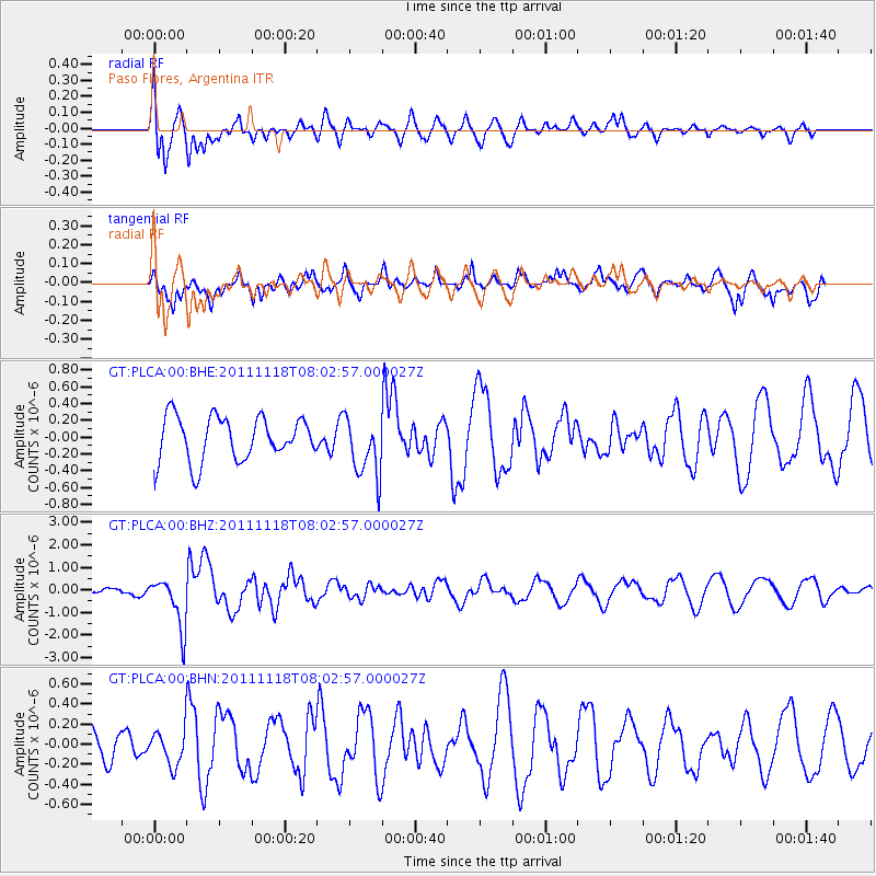
Earthquake location: Off E. Coast Of N. Island, N.Z.
Earthquake latitude/longitude: -37.8/179.4
Earthquake time(UTC): 2011/11/18 (322) 07:51:24 GMT
Earthquake Depth: 12 km
Earthquake Magnitude: 5.8 MB, 5.6 MS, 5.8 MW, 5.7 MW
Earthquake Catalog/Contributor: WHDF/NEIC
Network: GT Global Telemetered Seismograph Network (USAF/USGS)
Station: PLCA Paso Flores, Argentina
Lat/Lon: 40.73 S/70.55 W
Elevation: 1050 m
Distance: 79.0 deg
Az: 133.341 deg
Baz: 229.294 deg
Ray Param: 0.049249064
Estimated Moho Depth: 32.0 km
Estimated Crust Vp/Vs: 1.80
Assumed Crust Vp: 6.597 km/s
Estimated Crust Vs: 3.675 km/s
Estimated Crust Poisson's Ratio: 0.27
Radial Match: 80.13741 %
Radial Bump: 400
Transverse Match: 64.99411 %
Transverse Bump: 387
SOD ConfigId: 432046
Insert Time: 2012-02-28 07:11:39.780 +0000
GWidth: 2.5
Max Bumps: 400
Tol: 0.001

Signal To Noise

ChannelStoNSTALTA
GT:PLCA:00:BHZ:20111118T08:02:57.000027Z9.9707181.1021567E-61.1053935E-7
GT:PLCA:00:BHN:20111118T08:02:57.000027Z0.67004771.790921E-72.672826E-7
GT:PLCA:00:BHE:20111118T08:02:57.000027Z1.36976953.5626582E-72.600918E-7
Arrivals
Ps4.0 SECOND
PpPs13 SECOND
PsPs/PpSs17 SECOND