You are here: Home > Network List > G - GEOSCOPE Stations List
> Station TAM Tamanrasset, Algeria > Earthquake Result Viewer
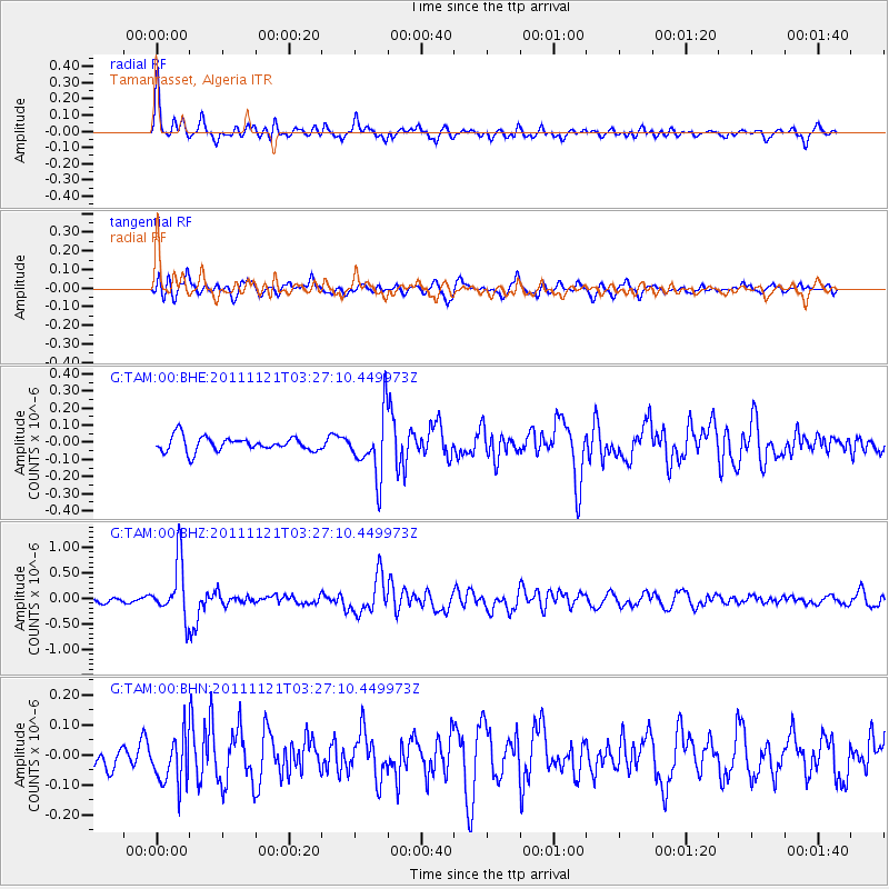
TAM Tamanrasset, Algeria - Earthquake Result Viewer
*The percent match for this event was below the threshold and hence no stack was calculated.
| Earthquake location: |
Myanmar |
| Earthquake latitude/longitude: |
25.0/95.2 |
| Earthquake time(UTC): |
2011/11/21 (325) 03:15:42 GMT |
| Earthquake Depth: |
114 km |
| Earthquake Magnitude: |
5.9 MB, 5.7 MW, 5.7 MW |
| Earthquake Catalog/Contributor: |
WHDF/NEIC |
|
| Network: |
G GEOSCOPE |
| Station: |
TAM Tamanrasset, Algeria |
| Lat/Lon: |
22.79 N/5.53 E |
| Elevation: |
1377 m |
|
| Distance: |
80.5 deg |
| Az: |
290.643 deg |
| Baz: |
66.993 deg |
| Ray Param: |
$rayparam |
*The percent match for this event was below the threshold and hence was not used in the summary stack. |
|
| Radial Match: |
69.516945 % |
| Radial Bump: |
400 |
| Transverse Match: |
64.71813 % |
| Transverse Bump: |
400 |
| SOD ConfigId: |
432046 |
| Insert Time: |
2012-03-03 05:16:05.872 +0000 |
| GWidth: |
2.5 |
| Max Bumps: |
400 |
| Tol: |
0.001 |
|
Signal To Noise
| Channel | StoN | STA | LTA |
| G:TAM:00:BHZ:20111121T03:27:10.449973Z | 6.709237 | 5.4313927E-7 | 8.095395E-8 |
| G:TAM:00:BHN:20111121T03:27:10.449973Z | 1.0614616 | 7.9192E-8 | 7.460657E-8 |
| G:TAM:00:BHE:20111121T03:27:10.449973Z | 4.2955847 | 1.8084158E-7 | 4.209941E-8 |
| Arrivals |
| Ps | |
| PpPs | |
| PsPs/PpSs | |


