You are here: Home > Network List > G - GEOSCOPE Stations List
> Station ATD Arta Cave - Arta, Republic of Djibouti > Earthquake Result Viewer
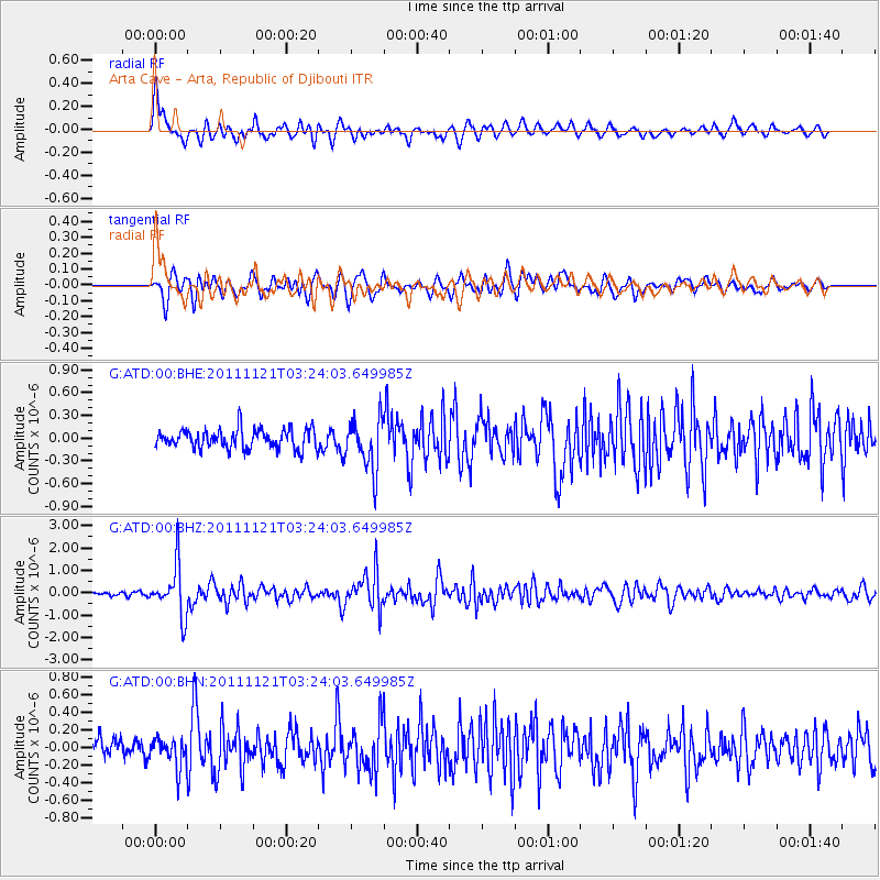
ATD Arta Cave - Arta, Republic of Djibouti - Earthquake Result Viewer
*The percent match for this event was below the threshold and hence no stack was calculated.
| Earthquake location: |
Myanmar |
| Earthquake latitude/longitude: |
25.0/95.2 |
| Earthquake time(UTC): |
2011/11/21 (325) 03:15:42 GMT |
| Earthquake Depth: |
114 km |
| Earthquake Magnitude: |
5.9 MB, 5.7 MW, 5.7 MW |
| Earthquake Catalog/Contributor: |
WHDF/NEIC |
|
| Network: |
G GEOSCOPE |
| Station: |
ATD Arta Cave - Arta, Republic of Djibouti |
| Lat/Lon: |
11.53 N/42.85 E |
| Elevation: |
610 m |
|
| Distance: |
51.2 deg |
| Az: |
264.798 deg |
| Baz: |
67.273 deg |
| Ray Param: |
$rayparam |
*The percent match for this event was below the threshold and hence was not used in the summary stack. |
|
| Radial Match: |
79.84352 % |
| Radial Bump: |
400 |
| Transverse Match: |
74.64664 % |
| Transverse Bump: |
400 |
| SOD ConfigId: |
432046 |
| Insert Time: |
2012-03-03 05:16:24.565 +0000 |
| GWidth: |
2.5 |
| Max Bumps: |
400 |
| Tol: |
0.001 |
|
Signal To Noise
| Channel | StoN | STA | LTA |
| G:ATD:00:BHZ:20111121T03:24:03.649985Z | 15.081214 | 1.1146145E-6 | 7.390748E-8 |
| G:ATD:00:BHN:20111121T03:24:03.649985Z | 1.3895018 | 1.6941482E-7 | 1.2192486E-7 |
| G:ATD:00:BHE:20111121T03:24:03.649985Z | 2.6952267 | 3.452789E-7 | 1.2810756E-7 |
| Arrivals |
| Ps | |
| PpPs | |
| PsPs/PpSs | |


