You are here: Home > Network List > IW - Intermountain West Stations List
> Station MOOW Moose Ponds, Wyoming, USA > Earthquake Result Viewer
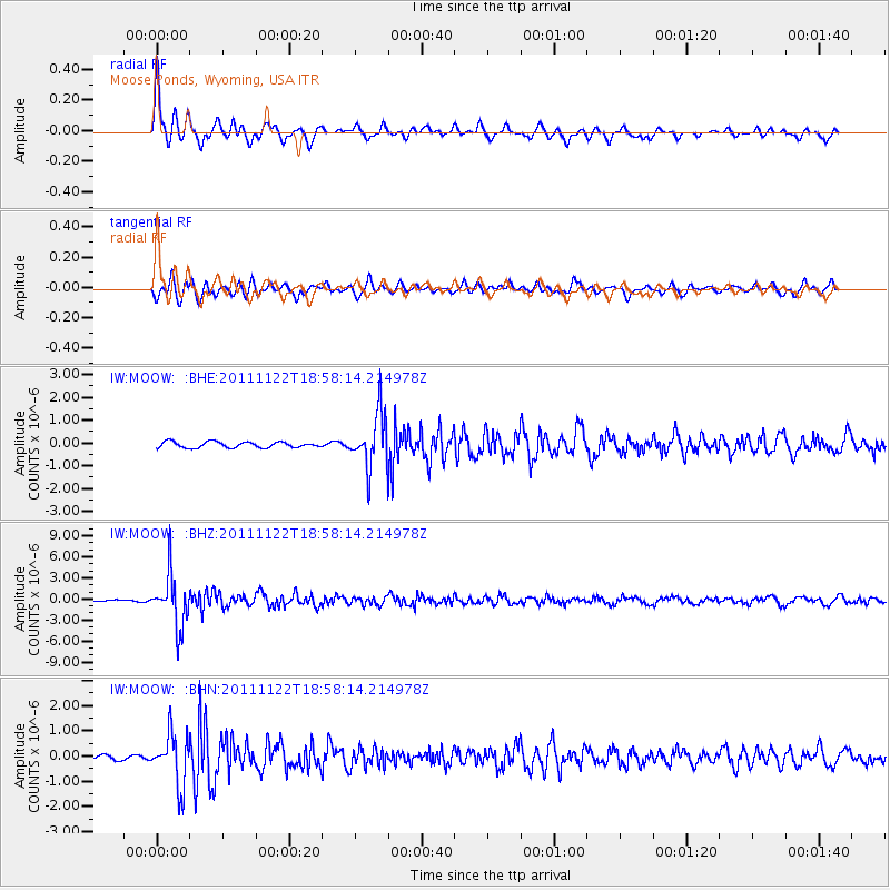
MOOW Moose Ponds, Wyoming, USA - Earthquake Result Viewer
*The percent match for this event was below the threshold and hence no stack was calculated.
| Earthquake location: |
Central Bolivia |
| Earthquake latitude/longitude: |
-15.4/-65.1 |
| Earthquake time(UTC): |
2011/11/22 (326) 18:48:16 GMT |
| Earthquake Depth: |
550 km |
| Earthquake Magnitude: |
6.2 MB, 6.6 MW, 6.6 MW |
| Earthquake Catalog/Contributor: |
WHDF/NEIC |
|
| Network: |
IW Intermountain West |
| Station: |
MOOW Moose Ponds, Wyoming, USA |
| Lat/Lon: |
43.75 N/110.74 W |
| Elevation: |
2128 m |
|
| Distance: |
72.1 deg |
| Az: |
327.003 deg |
| Baz: |
133.533 deg |
| Ray Param: |
$rayparam |
*The percent match for this event was below the threshold and hence was not used in the summary stack. |
|
| Radial Match: |
75.1054 % |
| Radial Bump: |
390 |
| Transverse Match: |
77.16313 % |
| Transverse Bump: |
400 |
| SOD ConfigId: |
432046 |
| Insert Time: |
2012-03-03 05:35:08.049 +0000 |
| GWidth: |
2.5 |
| Max Bumps: |
400 |
| Tol: |
0.001 |
|
Signal To Noise
| Channel | StoN | STA | LTA |
| IW:MOOW: :BHZ:20111122T18:58:14.214978Z | 27.773088 | 3.6924907E-6 | 1.3295211E-7 |
| IW:MOOW: :BHN:20111122T18:58:14.214978Z | 5.8707404 | 1.0206641E-6 | 1.738561E-7 |
| IW:MOOW: :BHE:20111122T18:58:14.214978Z | 9.447202 | 1.2010734E-6 | 1.2713537E-7 |
| Arrivals |
| Ps | |
| PpPs | |
| PsPs/PpSs | |


