You are here: Home > Network List > TA - USArray Transportable Network (new EarthScope stations) Stations List
> Station E31A Nome, ND, USA > Earthquake Result Viewer
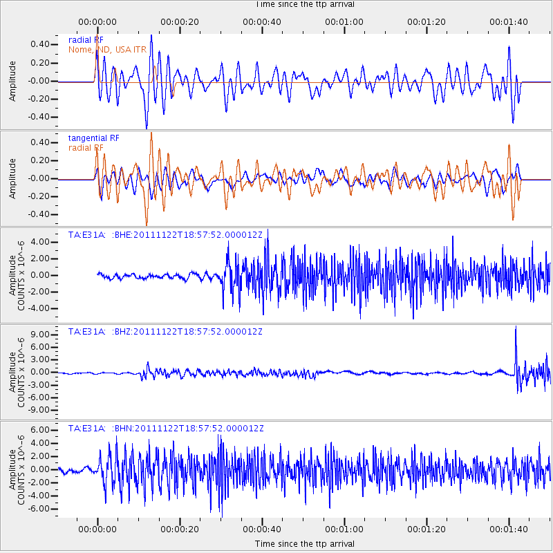
E31A Nome, ND, USA - Earthquake Result Viewer
*The percent match for this event was below the threshold and hence no stack was calculated.
| Earthquake location: |
Central Bolivia |
| Earthquake latitude/longitude: |
-15.4/-65.1 |
| Earthquake time(UTC): |
2011/11/22 (326) 18:48:16 GMT |
| Earthquake Depth: |
550 km |
| Earthquake Magnitude: |
6.2 MB, 6.6 MW, 6.6 MW |
| Earthquake Catalog/Contributor: |
WHDF/NEIC |
|
| Network: |
TA USArray Transportable Network (new EarthScope stations) |
| Station: |
E31A Nome, ND, USA |
| Lat/Lon: |
46.56 N/97.89 W |
| Elevation: |
427 m |
|
| Distance: |
68.3 deg |
| Az: |
336.286 deg |
| Baz: |
145.789 deg |
| Ray Param: |
$rayparam |
*The percent match for this event was below the threshold and hence was not used in the summary stack. |
|
| Radial Match: |
35.576347 % |
| Radial Bump: |
378 |
| Transverse Match: |
31.338303 % |
| Transverse Bump: |
331 |
| SOD ConfigId: |
432046 |
| Insert Time: |
2012-03-03 05:51:49.789 +0000 |
| GWidth: |
2.5 |
| Max Bumps: |
400 |
| Tol: |
0.001 |
|
Signal To Noise
| Channel | StoN | STA | LTA |
| TA:E31A: :BHZ:20111122T18:57:52.000012Z | 0.83663803 | 1.5075513E-7 | 1.8019156E-7 |
| TA:E31A: :BHN:20111122T18:57:52.000012Z | 6.0754986 | 2.0393766E-6 | 3.356723E-7 |
| TA:E31A: :BHE:20111122T18:57:52.000012Z | 6.8858767 | 1.7521749E-6 | 2.5445922E-7 |
| Arrivals |
| Ps | |
| PpPs | |
| PsPs/PpSs | |


