You are here: Home > Network List > TA - USArray Transportable Network (new EarthScope stations) Stations List
> Station C33A Trail, MN, USA > Earthquake Result Viewer
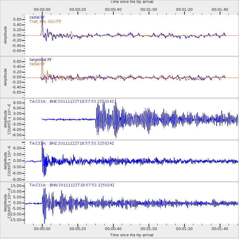
C33A Trail, MN, USA - Earthquake Result Viewer
*The percent match for this event was below the threshold and hence no stack was calculated.
| Earthquake location: |
Central Bolivia |
| Earthquake latitude/longitude: |
-15.4/-65.1 |
| Earthquake time(UTC): |
2011/11/22 (326) 18:48:16 GMT |
| Earthquake Depth: |
550 km |
| Earthquake Magnitude: |
6.2 MB, 6.6 MW, 6.6 MW |
| Earthquake Catalog/Contributor: |
WHDF/NEIC |
|
| Network: |
TA USArray Transportable Network (new EarthScope stations) |
| Station: |
C33A Trail, MN, USA |
| Lat/Lon: |
47.76 N/95.77 W |
| Elevation: |
388 m |
|
| Distance: |
68.6 deg |
| Az: |
338.291 deg |
| Baz: |
148.072 deg |
| Ray Param: |
$rayparam |
*The percent match for this event was below the threshold and hence was not used in the summary stack. |
|
| Radial Match: |
73.184715 % |
| Radial Bump: |
400 |
| Transverse Match: |
55.76291 % |
| Transverse Bump: |
400 |
| SOD ConfigId: |
432046 |
| Insert Time: |
2012-03-03 05:52:55.229 +0000 |
| GWidth: |
2.5 |
| Max Bumps: |
400 |
| Tol: |
0.001 |
|
Signal To Noise
| Channel | StoN | STA | LTA |
| TA:C33A: :BHZ:20111122T18:57:53.325024Z | 14.911938 | 3.0869564E-6 | 2.0701243E-7 |
| TA:C33A: :BHN:20111122T18:57:53.325024Z | 26.633404 | 6.3111825E-6 | 2.3696492E-7 |
| TA:C33A: :BHE:20111122T18:57:53.325024Z | 28.91524 | 4.438914E-6 | 1.5351469E-7 |
| Arrivals |
| Ps | |
| PpPs | |
| PsPs/PpSs | |


