HYB Hyderabad, India - Earthquake Result Viewer
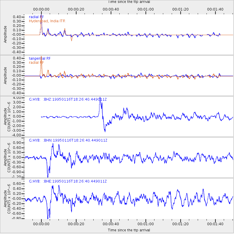
Earthquake location: Rat Islands, Aleutian Islands
Earthquake latitude/longitude: 51.2/179.2
Earthquake time(UTC): 1995/01/16 (016) 18:14:49 GMT
Earthquake Depth: 33 km
Earthquake Magnitude: 5.5 MB, 6.0 MS, 6.3 UNKNOWN, 6.1 MW
Earthquake Catalog/Contributor: WHDF/NEIC
Network: G GEOSCOPE
Station: HYB Hyderabad, India
Lat/Lon: 17.42 N/78.55 E
Elevation: 510 m
Distance: 83.1 deg
Az: 289.04 deg
Baz: 38.491 deg
Ray Param: 0.046409573
Estimated Moho Depth: 32.0 km
Estimated Crust Vp/Vs: 1.80
Assumed Crust Vp: 6.459 km/s
Estimated Crust Vs: 3.594 km/s
Estimated Crust Poisson's Ratio: 0.28
Radial Match: 94.93938 %
Radial Bump: 337
Transverse Match: 79.17397 %
Transverse Bump: 400
SOD ConfigId: 6273
Insert Time: 2010-02-26 22:52:26.357 +0000
GWidth: 2.5
Max Bumps: 400
Tol: 0.001

Signal To Noise

ChannelStoNSTALTA
G:HYB: :BHN:19950116T18:26:40.449011Z9.4558714.5461172E-74.8077197E-8
G:HYB: :BHE:19950116T18:26:40.449011Z4.73370273.1346835E-76.6220544E-8
G:HYB: :BHZ:19950116T18:26:40.449011Z17.2877241.5993498E-69.251362E-8
Arrivals
Ps4.1 SECOND
PpPs14 SECOND
PsPs/PpSs18 SECOND