You are here: Home > Network List > TA - USArray Transportable Network (new EarthScope stations) Stations List
> Station E37A Wrenshall, MN, USA > Earthquake Result Viewer
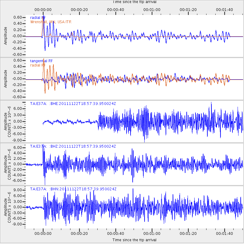
E37A Wrenshall, MN, USA - Earthquake Result Viewer
*The percent match for this event was below the threshold and hence no stack was calculated.
| Earthquake location: |
Central Bolivia |
| Earthquake latitude/longitude: |
-15.4/-65.1 |
| Earthquake time(UTC): |
2011/11/22 (326) 18:48:16 GMT |
| Earthquake Depth: |
550 km |
| Earthquake Magnitude: |
6.2 MB, 6.6 MW, 6.6 MW |
| Earthquake Catalog/Contributor: |
WHDF/NEIC |
|
| Network: |
TA USArray Transportable Network (new EarthScope stations) |
| Station: |
E37A Wrenshall, MN, USA |
| Lat/Lon: |
46.57 N/92.40 W |
| Elevation: |
304 m |
|
| Distance: |
66.4 deg |
| Az: |
339.786 deg |
| Baz: |
151.11 deg |
| Ray Param: |
$rayparam |
*The percent match for this event was below the threshold and hence was not used in the summary stack. |
|
| Radial Match: |
63.42889 % |
| Radial Bump: |
400 |
| Transverse Match: |
48.833035 % |
| Transverse Bump: |
400 |
| SOD ConfigId: |
432046 |
| Insert Time: |
2012-03-03 05:55:52.921 +0000 |
| GWidth: |
2.5 |
| Max Bumps: |
400 |
| Tol: |
0.001 |
|
Signal To Noise
| Channel | StoN | STA | LTA |
| TA:E37A: :BHZ:20111122T18:57:39.950024Z | 9.923944 | 2.5313343E-6 | 2.5507342E-7 |
| TA:E37A: :BHN:20111122T18:57:39.950024Z | 10.805589 | 3.4027153E-6 | 3.1490328E-7 |
| TA:E37A: :BHE:20111122T18:57:39.950024Z | 4.688368 | 1.9961226E-6 | 4.2576065E-7 |
| Arrivals |
| Ps | |
| PpPs | |
| PsPs/PpSs | |


