You are here: Home > Network List > TA - USArray Transportable Network (new EarthScope stations) Stations List
> Station T40A Mansfield, MO, USA > Earthquake Result Viewer
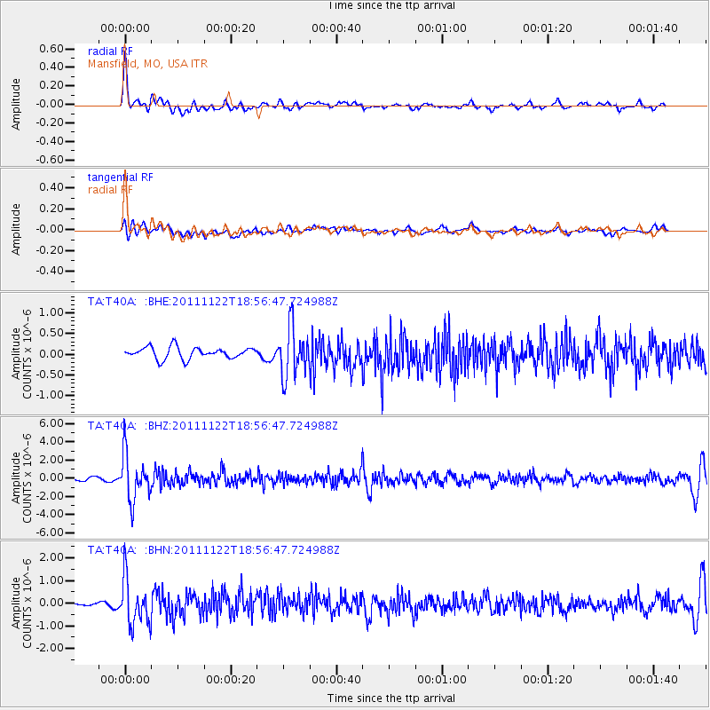
T40A Mansfield, MO, USA - Earthquake Result Viewer
*The percent match for this event was below the threshold and hence no stack was calculated.
| Earthquake location: |
Central Bolivia |
| Earthquake latitude/longitude: |
-15.4/-65.1 |
| Earthquake time(UTC): |
2011/11/22 (326) 18:48:16 GMT |
| Earthquake Depth: |
550 km |
| Earthquake Magnitude: |
6.2 MB, 6.6 MW, 6.6 MW |
| Earthquake Catalog/Contributor: |
WHDF/NEIC |
|
| Network: |
TA USArray Transportable Network (new EarthScope stations) |
| Station: |
T40A Mansfield, MO, USA |
| Lat/Lon: |
37.15 N/92.52 W |
| Elevation: |
399 m |
|
| Distance: |
58.3 deg |
| Az: |
334.36 deg |
| Baz: |
148.503 deg |
| Ray Param: |
$rayparam |
*The percent match for this event was below the threshold and hence was not used in the summary stack. |
|
| Radial Match: |
78.7161 % |
| Radial Bump: |
400 |
| Transverse Match: |
61.876957 % |
| Transverse Bump: |
400 |
| SOD ConfigId: |
432046 |
| Insert Time: |
2012-03-03 05:59:27.215 +0000 |
| GWidth: |
2.5 |
| Max Bumps: |
400 |
| Tol: |
0.001 |
|
Signal To Noise
| Channel | StoN | STA | LTA |
| TA:T40A: :BHZ:20111122T18:56:47.724988Z | 12.1287775 | 2.5338015E-6 | 2.0890823E-7 |
| TA:T40A: :BHN:20111122T18:56:47.724988Z | 5.439758 | 1.0433093E-6 | 1.9179333E-7 |
| TA:T40A: :BHE:20111122T18:56:47.724988Z | 4.38329 | 6.054781E-7 | 1.3813325E-7 |
| Arrivals |
| Ps | |
| PpPs | |
| PsPs/PpSs | |


