You are here: Home > Network List > TA - USArray Transportable Network (new EarthScope stations) Stations List
> Station M42A Sheffield, IL, USA > Earthquake Result Viewer
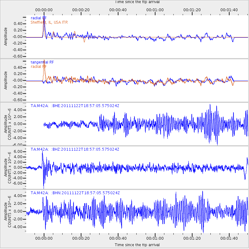
M42A Sheffield, IL, USA - Earthquake Result Viewer
*The percent match for this event was below the threshold and hence no stack was calculated.
| Earthquake location: |
Central Bolivia |
| Earthquake latitude/longitude: |
-15.4/-65.1 |
| Earthquake time(UTC): |
2011/11/22 (326) 18:48:16 GMT |
| Earthquake Depth: |
550 km |
| Earthquake Magnitude: |
6.2 MB, 6.6 MW, 6.6 MW |
| Earthquake Catalog/Contributor: |
WHDF/NEIC |
|
| Network: |
TA USArray Transportable Network (new EarthScope stations) |
| Station: |
M42A Sheffield, IL, USA |
| Lat/Lon: |
41.45 N/89.76 W |
| Elevation: |
212 m |
|
| Distance: |
61.0 deg |
| Az: |
338.973 deg |
| Baz: |
152.58 deg |
| Ray Param: |
$rayparam |
*The percent match for this event was below the threshold and hence was not used in the summary stack. |
|
| Radial Match: |
65.93401 % |
| Radial Bump: |
400 |
| Transverse Match: |
43.138634 % |
| Transverse Bump: |
400 |
| SOD ConfigId: |
432046 |
| Insert Time: |
2012-03-03 06:09:22.075 +0000 |
| GWidth: |
2.5 |
| Max Bumps: |
400 |
| Tol: |
0.001 |
|
Signal To Noise
| Channel | StoN | STA | LTA |
| TA:M42A: :BHZ:20111122T18:57:05.575024Z | 9.942789 | 2.6836397E-6 | 2.6990816E-7 |
| TA:M42A: :BHN:20111122T18:57:05.575024Z | 3.9456031 | 1.8702555E-6 | 4.7401002E-7 |
| TA:M42A: :BHE:20111122T18:57:05.575024Z | 2.532645 | 1.2318866E-6 | 4.8640317E-7 |
| Arrivals |
| Ps | |
| PpPs | |
| PsPs/PpSs | |


