You are here: Home > Network List > TA - USArray Transportable Network (new EarthScope stations) Stations List
> Station E41A Kenton, MI, USA > Earthquake Result Viewer
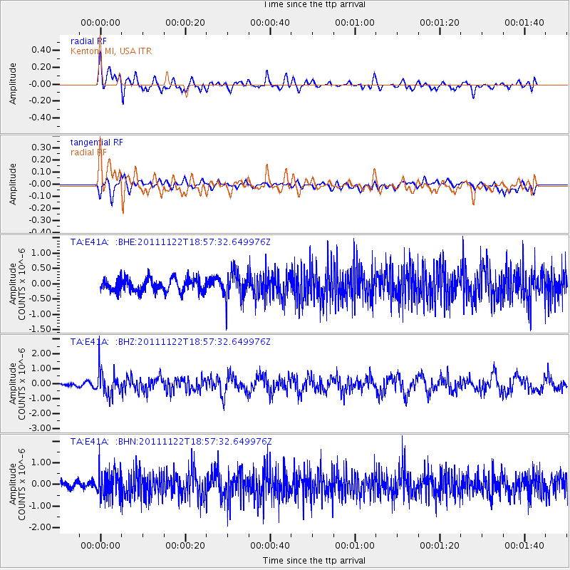
E41A Kenton, MI, USA - Earthquake Result Viewer
*The percent match for this event was below the threshold and hence no stack was calculated.
| Earthquake location: |
Central Bolivia |
| Earthquake latitude/longitude: |
-15.4/-65.1 |
| Earthquake time(UTC): |
2011/11/22 (326) 18:48:16 GMT |
| Earthquake Depth: |
550 km |
| Earthquake Magnitude: |
6.2 MB, 6.6 MW, 6.6 MW |
| Earthquake Catalog/Contributor: |
WHDF/NEIC |
|
| Network: |
TA USArray Transportable Network (new EarthScope stations) |
| Station: |
E41A Kenton, MI, USA |
| Lat/Lon: |
46.46 N/88.96 W |
| Elevation: |
377 m |
|
| Distance: |
65.2 deg |
| Az: |
342.05 deg |
| Baz: |
154.525 deg |
| Ray Param: |
$rayparam |
*The percent match for this event was below the threshold and hence was not used in the summary stack. |
|
| Radial Match: |
60.18645 % |
| Radial Bump: |
400 |
| Transverse Match: |
42.533627 % |
| Transverse Bump: |
400 |
| SOD ConfigId: |
432046 |
| Insert Time: |
2012-03-03 06:12:56.035 +0000 |
| GWidth: |
2.5 |
| Max Bumps: |
400 |
| Tol: |
0.001 |
|
Signal To Noise
| Channel | StoN | STA | LTA |
| TA:E41A: :BHZ:20111122T18:57:32.649976Z | 4.0593147 | 8.3874255E-7 | 2.0662172E-7 |
| TA:E41A: :BHN:20111122T18:57:32.649976Z | 3.0951967 | 6.1772573E-7 | 1.995756E-7 |
| TA:E41A: :BHE:20111122T18:57:32.649976Z | 2.0953503 | 4.4089734E-7 | 2.10417E-7 |
| Arrivals |
| Ps | |
| PpPs | |
| PsPs/PpSs | |


